You are here: Home > Network List > UW - Pacific Northwest Regional Seismic Network Stations List
> Station UMAT Pilot Rock, OR, USA > Earthquake Result Viewer
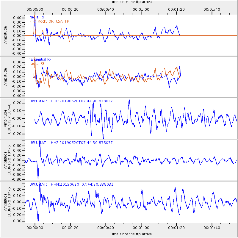
UMAT Pilot Rock, OR, USA - Earthquake Result Viewer
*The percent match for this event was below the threshold and hence no stack was calculated.
| Earthquake location: |
Tonga Islands |
| Earthquake latitude/longitude: |
-17.7/-173.7 |
| Earthquake time(UTC): |
2019/06/20 (171) 07:32:57 GMT |
| Earthquake Depth: |
42 km |
| Earthquake Magnitude: |
5.6 mb |
| Earthquake Catalog/Contributor: |
NEIC PDE/us |
|
| Network: |
UW Pacific Northwest Regional Seismic Network |
| Station: |
UMAT Pilot Rock, OR, USA |
| Lat/Lon: |
45.29 N/118.96 W |
| Elevation: |
1318 m |
|
| Distance: |
79.9 deg |
| Az: |
35.84 deg |
| Baz: |
232.267 deg |
| Ray Param: |
$rayparam |
*The percent match for this event was below the threshold and hence was not used in the summary stack. |
|
| Radial Match: |
69.472916 % |
| Radial Bump: |
400 |
| Transverse Match: |
52.591545 % |
| Transverse Bump: |
400 |
| SOD ConfigId: |
18369291 |
| Insert Time: |
2019-07-04 07:42:09.298 +0000 |
| GWidth: |
2.5 |
| Max Bumps: |
400 |
| Tol: |
0.001 |
|
Signal To Noise
| Channel | StoN | STA | LTA |
| UW:UMAT: :HHZ:20190620T07:44:30.83803Z | 5.0862656 | 3.2880217E-7 | 6.46451E-8 |
| UW:UMAT: :HHN:20190620T07:44:30.83803Z | 2.856979 | 1.4268171E-7 | 4.9941463E-8 |
| UW:UMAT: :HHE:20190620T07:44:30.83803Z | 2.3502095 | 1.1464624E-7 | 4.8781285E-8 |
| Arrivals |
| Ps | |
| PpPs | |
| PsPs/PpSs | |


