You are here: Home > Network List > TA - USArray Transportable Network (new EarthScope stations) Stations List
> Station C23A Lambert, MT, USA > Earthquake Result Viewer
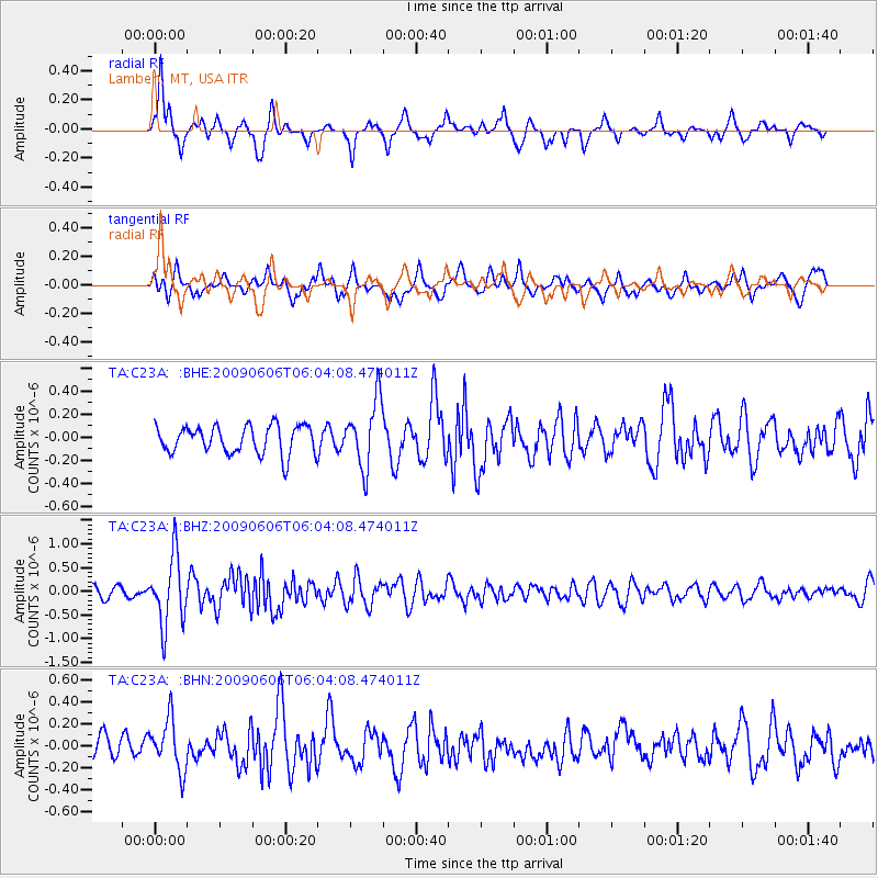
C23A Lambert, MT, USA - Earthquake Result Viewer
*The percent match for this event was below the threshold and hence no stack was calculated.
| Earthquake location: |
Near East Coast Of Honshu, Japan |
| Earthquake latitude/longitude: |
35.5/140.9 |
| Earthquake time(UTC): |
2009/06/06 (157) 05:52:43 GMT |
| Earthquake Depth: |
34 km |
| Earthquake Magnitude: |
5.8 MB, 5.4 MS, 5.8 MW, 5.7 MW |
| Earthquake Catalog/Contributor: |
WHDF/NEIC |
|
| Network: |
TA USArray Transportable Network (new EarthScope stations) |
| Station: |
C23A Lambert, MT, USA |
| Lat/Lon: |
47.80 N/105.18 W |
| Elevation: |
729 m |
|
| Distance: |
78.2 deg |
| Az: |
39.018 deg |
| Baz: |
310.346 deg |
| Ray Param: |
$rayparam |
*The percent match for this event was below the threshold and hence was not used in the summary stack. |
|
| Radial Match: |
73.17015 % |
| Radial Bump: |
347 |
| Transverse Match: |
57.934143 % |
| Transverse Bump: |
400 |
| SOD ConfigId: |
2648 |
| Insert Time: |
2010-03-07 00:17:05.299 +0000 |
| GWidth: |
2.5 |
| Max Bumps: |
400 |
| Tol: |
0.001 |
|
Signal To Noise
| Channel | StoN | STA | LTA |
| TA:C23A: :BHZ:20090606T06:04:08.474011Z | 7.0340214 | 7.2280375E-7 | 1.0275825E-7 |
| TA:C23A: :BHN:20090606T06:04:08.474011Z | 1.639243 | 2.330494E-7 | 1.4216893E-7 |
| TA:C23A: :BHE:20090606T06:04:08.474011Z | 2.4160419 | 2.9157215E-7 | 1.2068175E-7 |
| Arrivals |
| Ps | |
| PpPs | |
| PsPs/PpSs | |


