You are here: Home > Network List > TA - USArray Transportable Network (new EarthScope stations) Stations List
> Station C23A Lambert, MT, USA > Earthquake Result Viewer
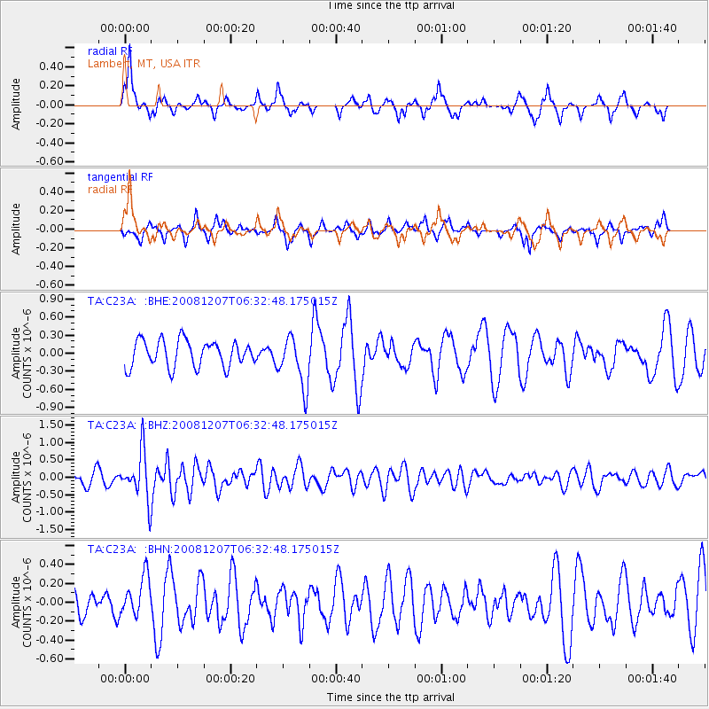
C23A Lambert, MT, USA - Earthquake Result Viewer
*The percent match for this event was below the threshold and hence no stack was calculated.
| Earthquake location: |
Northern Mid-Atlantic Ridge |
| Earthquake latitude/longitude: |
13.4/-44.8 |
| Earthquake time(UTC): |
2008/12/07 (342) 06:23:09 GMT |
| Earthquake Depth: |
10 km |
| Earthquake Magnitude: |
5.6 MB, 5.3 MS, 5.7 MW |
| Earthquake Catalog/Contributor: |
WHDF/NEIC |
|
| Network: |
TA USArray Transportable Network (new EarthScope stations) |
| Station: |
C23A Lambert, MT, USA |
| Lat/Lon: |
47.80 N/105.18 W |
| Elevation: |
729 m |
|
| Distance: |
60.4 deg |
| Az: |
317.631 deg |
| Baz: |
103.357 deg |
| Ray Param: |
$rayparam |
*The percent match for this event was below the threshold and hence was not used in the summary stack. |
|
| Radial Match: |
52.60961 % |
| Radial Bump: |
288 |
| Transverse Match: |
49.351162 % |
| Transverse Bump: |
278 |
| SOD ConfigId: |
2658 |
| Insert Time: |
2010-03-07 00:17:10.788 +0000 |
| GWidth: |
2.5 |
| Max Bumps: |
400 |
| Tol: |
0.001 |
|
Signal To Noise
| Channel | StoN | STA | LTA |
| TA:C23A: :BHZ:20081207T06:32:48.175015Z | 3.9662294 | 6.8586814E-7 | 1.7292699E-7 |
| TA:C23A: :BHN:20081207T06:32:48.175015Z | 0.7727909 | 2.1586646E-7 | 2.793336E-7 |
| TA:C23A: :BHE:20081207T06:32:48.175015Z | 1.9277002 | 4.210541E-7 | 2.1842303E-7 |
| Arrivals |
| Ps | |
| PpPs | |
| PsPs/PpSs | |


