You are here: Home > Network List > TA - USArray Transportable Network (new EarthScope stations) Stations List
> Station C23A Lambert, MT, USA > Earthquake Result Viewer
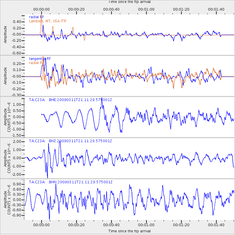
C23A Lambert, MT, USA - Earthquake Result Viewer
*The percent match for this event was below the threshold and hence no stack was calculated.
| Earthquake location: |
Costa Rica |
| Earthquake latitude/longitude: |
8.5/-83.2 |
| Earthquake time(UTC): |
2009/03/11 (070) 21:03:58 GMT |
| Earthquake Depth: |
17 km |
| Earthquake Magnitude: |
5.7 MB, 5.6 MS, 5.9 MW, 5.8 MW |
| Earthquake Catalog/Contributor: |
WHDF/NEIC |
|
| Network: |
TA USArray Transportable Network (new EarthScope stations) |
| Station: |
C23A Lambert, MT, USA |
| Lat/Lon: |
47.80 N/105.18 W |
| Elevation: |
729 m |
|
| Distance: |
43.4 deg |
| Az: |
338.449 deg |
| Baz: |
147.387 deg |
| Ray Param: |
$rayparam |
*The percent match for this event was below the threshold and hence was not used in the summary stack. |
|
| Radial Match: |
42.267113 % |
| Radial Bump: |
400 |
| Transverse Match: |
39.372894 % |
| Transverse Bump: |
400 |
| SOD ConfigId: |
2658 |
| Insert Time: |
2010-03-07 00:17:13.365 +0000 |
| GWidth: |
2.5 |
| Max Bumps: |
400 |
| Tol: |
0.001 |
|
Signal To Noise
| Channel | StoN | STA | LTA |
| TA:C23A: :BHZ:20090311T21:11:29.575001Z | 6.726787 | 9.523572E-7 | 1.4157683E-7 |
| TA:C23A: :BHN:20090311T21:11:29.575001Z | 1.8311155 | 4.2205608E-7 | 2.3049125E-7 |
| TA:C23A: :BHE:20090311T21:11:29.575001Z | 2.1203518 | 7.986587E-7 | 3.7666328E-7 |
| Arrivals |
| Ps | |
| PpPs | |
| PsPs/PpSs | |


