You are here: Home > Network List > TA - USArray Transportable Network (new EarthScope stations) Stations List
> Station C23A Lambert, MT, USA > Earthquake Result Viewer
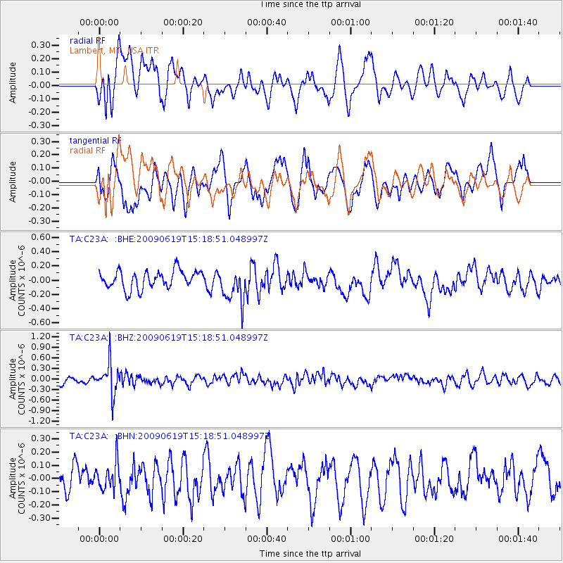
C23A Lambert, MT, USA - Earthquake Result Viewer
*The percent match for this event was below the threshold and hence no stack was calculated.
| Earthquake location: |
Mariana Islands |
| Earthquake latitude/longitude: |
14.1/145.2 |
| Earthquake time(UTC): |
2009/06/19 (170) 15:06:24 GMT |
| Earthquake Depth: |
114 km |
| Earthquake Magnitude: |
5.5 MB, 5.5 MW |
| Earthquake Catalog/Contributor: |
WHDF/NEIC |
|
| Network: |
TA USArray Transportable Network (new EarthScope stations) |
| Station: |
C23A Lambert, MT, USA |
| Lat/Lon: |
47.80 N/105.18 W |
| Elevation: |
729 m |
|
| Distance: |
92.4 deg |
| Az: |
39.46 deg |
| Baz: |
293.828 deg |
| Ray Param: |
$rayparam |
*The percent match for this event was below the threshold and hence was not used in the summary stack. |
|
| Radial Match: |
53.93114 % |
| Radial Bump: |
400 |
| Transverse Match: |
52.35772 % |
| Transverse Bump: |
400 |
| SOD ConfigId: |
2648 |
| Insert Time: |
2010-03-07 00:17:20.135 +0000 |
| GWidth: |
2.5 |
| Max Bumps: |
400 |
| Tol: |
0.001 |
|
Signal To Noise
| Channel | StoN | STA | LTA |
| TA:C23A: :BHZ:20090619T15:18:51.048997Z | 5.786136 | 4.5085707E-7 | 7.7920234E-8 |
| TA:C23A: :BHN:20090619T15:18:51.048997Z | 0.68990177 | 1.05051406E-7 | 1.5227009E-7 |
| TA:C23A: :BHE:20090619T15:18:51.048997Z | 1.9930496 | 2.4982694E-7 | 1.2534908E-7 |
| Arrivals |
| Ps | |
| PpPs | |
| PsPs/PpSs | |


