You are here: Home > Network List > TA - USArray Transportable Network (new EarthScope stations) Stations List
> Station C23A Lambert, MT, USA > Earthquake Result Viewer
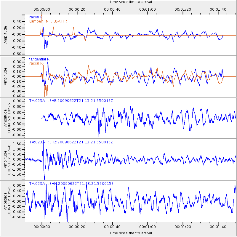
C23A Lambert, MT, USA - Earthquake Result Viewer
*The percent match for this event was below the threshold and hence no stack was calculated.
| Earthquake location: |
Andreanof Islands, Aleutian Is. |
| Earthquake latitude/longitude: |
51.3/-178.2 |
| Earthquake time(UTC): |
2009/06/22 (173) 21:05:33 GMT |
| Earthquake Depth: |
29 km |
| Earthquake Magnitude: |
5.5 MB, 5.0 MS, 5.4 MW, 5.4 MW |
| Earthquake Catalog/Contributor: |
WHDF/NEIC |
|
| Network: |
TA USArray Transportable Network (new EarthScope stations) |
| Station: |
C23A Lambert, MT, USA |
| Lat/Lon: |
47.80 N/105.18 W |
| Elevation: |
729 m |
|
| Distance: |
45.7 deg |
| Az: |
64.309 deg |
| Baz: |
303.035 deg |
| Ray Param: |
$rayparam |
*The percent match for this event was below the threshold and hence was not used in the summary stack. |
|
| Radial Match: |
41.827724 % |
| Radial Bump: |
400 |
| Transverse Match: |
44.309837 % |
| Transverse Bump: |
400 |
| SOD ConfigId: |
2648 |
| Insert Time: |
2010-03-07 00:17:23.586 +0000 |
| GWidth: |
2.5 |
| Max Bumps: |
400 |
| Tol: |
0.001 |
|
Signal To Noise
| Channel | StoN | STA | LTA |
| TA:C23A: :BHZ:20090622T21:13:21.550015Z | 5.4247503 | 8.3171585E-7 | 1.5331874E-7 |
| TA:C23A: :BHN:20090622T21:13:21.550015Z | 1.3604149 | 2.5049926E-7 | 1.8413445E-7 |
| TA:C23A: :BHE:20090622T21:13:21.550015Z | 2.1824844 | 3.4183867E-7 | 1.5662823E-7 |
| Arrivals |
| Ps | |
| PpPs | |
| PsPs/PpSs | |


