You are here: Home > Network List > AV - Alaska Volcano Observatory Stations List
> Station SPCR Ckakachatna River, Mount Spurr, Alaska > Earthquake Result Viewer
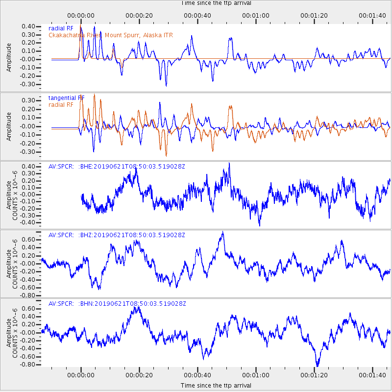
SPCR Ckakachatna River, Mount Spurr, Alaska - Earthquake Result Viewer
*The percent match for this event was below the threshold and hence no stack was calculated.
| Earthquake location: |
Kermadec Islands, New Zealand |
| Earthquake latitude/longitude: |
-30.8/-177.4 |
| Earthquake time(UTC): |
2019/06/21 (172) 08:37:20 GMT |
| Earthquake Depth: |
35 km |
| Earthquake Magnitude: |
6.2 Mww |
| Earthquake Catalog/Contributor: |
NEIC PDE/us |
|
| Network: |
AV Alaska Volcano Observatory |
| Station: |
SPCR Ckakachatna River, Mount Spurr, Alaska |
| Lat/Lon: |
61.20 N/152.21 W |
| Elevation: |
984 m |
|
| Distance: |
94.0 deg |
| Az: |
11.932 deg |
| Baz: |
201.552 deg |
| Ray Param: |
$rayparam |
*The percent match for this event was below the threshold and hence was not used in the summary stack. |
|
| Radial Match: |
75.07398 % |
| Radial Bump: |
400 |
| Transverse Match: |
62.62349 % |
| Transverse Bump: |
400 |
| SOD ConfigId: |
18369291 |
| Insert Time: |
2019-07-05 08:39:07.179 +0000 |
| GWidth: |
2.5 |
| Max Bumps: |
400 |
| Tol: |
0.001 |
|
Signal To Noise
| Channel | StoN | STA | LTA |
| AV:SPCR: :BHZ:20190621T08:50:03.519028Z | 3.630228 | 2.927515E-7 | 8.0642735E-8 |
| AV:SPCR: :BHN:20190621T08:50:03.519028Z | 0.74479055 | 1.4815573E-7 | 1.9892268E-7 |
| AV:SPCR: :BHE:20190621T08:50:03.519028Z | 0.8772057 | 1.3805813E-7 | 1.5738398E-7 |
| Arrivals |
| Ps | |
| PpPs | |
| PsPs/PpSs | |


