You are here: Home > Network List > TA - USArray Transportable Network (new EarthScope stations) Stations List
> Station C23A Lambert, MT, USA > Earthquake Result Viewer
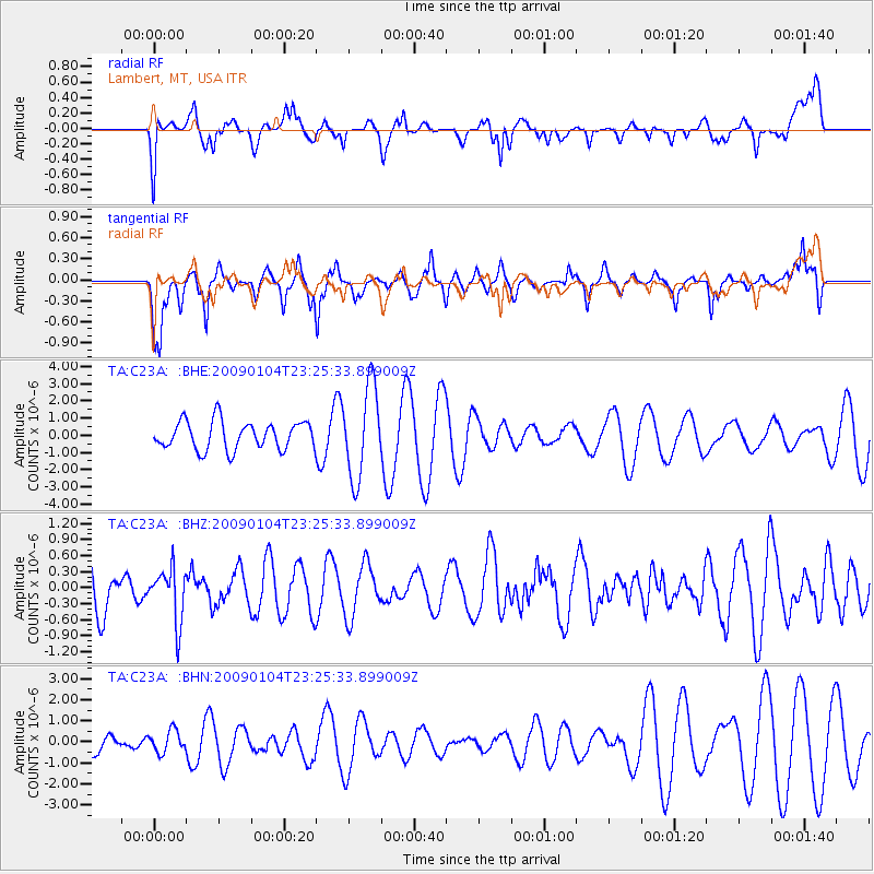
C23A Lambert, MT, USA - Earthquake Result Viewer
*The percent match for this event was below the threshold and hence no stack was calculated.
| Earthquake location: |
Hindu Kush Region, Afghanistan |
| Earthquake latitude/longitude: |
36.4/70.9 |
| Earthquake time(UTC): |
2009/01/04 (004) 23:12:59 GMT |
| Earthquake Depth: |
187 km |
| Earthquake Magnitude: |
5.7 MB, 5.7 MW, 5.6 MW |
| Earthquake Catalog/Contributor: |
WHDF/NEIC |
|
| Network: |
TA USArray Transportable Network (new EarthScope stations) |
| Station: |
C23A Lambert, MT, USA |
| Lat/Lon: |
47.80 N/105.18 W |
| Elevation: |
729 m |
|
| Distance: |
96.1 deg |
| Az: |
357.335 deg |
| Baz: |
3.188 deg |
| Ray Param: |
$rayparam |
*The percent match for this event was below the threshold and hence was not used in the summary stack. |
|
| Radial Match: |
48.519512 % |
| Radial Bump: |
400 |
| Transverse Match: |
53.847775 % |
| Transverse Bump: |
357 |
| SOD ConfigId: |
2834 |
| Insert Time: |
2010-03-07 00:17:46.200 +0000 |
| GWidth: |
2.5 |
| Max Bumps: |
400 |
| Tol: |
0.001 |
|
Signal To Noise
| Channel | StoN | STA | LTA |
| TA:C23A: :BHZ:20090104T23:25:33.899009Z | 0.8711551 | 4.9740686E-7 | 5.70974E-7 |
| TA:C23A: :BHN:20090104T23:25:33.899009Z | 0.65534496 | 5.193818E-7 | 7.9253186E-7 |
| TA:C23A: :BHE:20090104T23:25:33.899009Z | 3.2503605 | 2.644766E-6 | 8.136839E-7 |
| Arrivals |
| Ps | |
| PpPs | |
| PsPs/PpSs | |


