You are here: Home > Network List > TA - USArray Transportable Network (new EarthScope stations) Stations List
> Station C23A Lambert, MT, USA > Earthquake Result Viewer
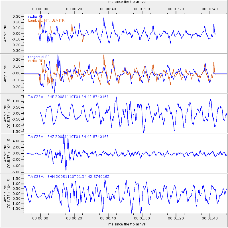
C23A Lambert, MT, USA - Earthquake Result Viewer
*The percent match for this event was below the threshold and hence no stack was calculated.
| Earthquake location: |
Qinghai, China |
| Earthquake latitude/longitude: |
37.6/95.8 |
| Earthquake time(UTC): |
2008/11/10 (315) 01:22:02 GMT |
| Earthquake Depth: |
19 km |
| Earthquake Magnitude: |
6.4 MB, 6.4 MS, 6.3 MW, 6.3 MW |
| Earthquake Catalog/Contributor: |
WHDF/NEIC |
|
| Network: |
TA USArray Transportable Network (new EarthScope stations) |
| Station: |
C23A Lambert, MT, USA |
| Lat/Lon: |
47.80 N/105.18 W |
| Elevation: |
729 m |
|
| Distance: |
93.0 deg |
| Az: |
14.011 deg |
| Baz: |
343.419 deg |
| Ray Param: |
$rayparam |
*The percent match for this event was below the threshold and hence was not used in the summary stack. |
|
| Radial Match: |
48.698467 % |
| Radial Bump: |
356 |
| Transverse Match: |
56.978313 % |
| Transverse Bump: |
400 |
| SOD ConfigId: |
2658 |
| Insert Time: |
2010-03-07 00:17:51.199 +0000 |
| GWidth: |
2.5 |
| Max Bumps: |
400 |
| Tol: |
0.001 |
|
Signal To Noise
| Channel | StoN | STA | LTA |
| TA:C23A: :BHZ:20081110T01:34:42.874016Z | 2.6226192 | 6.601928E-7 | 2.5173037E-7 |
| TA:C23A: :BHN:20081110T01:34:42.874016Z | 0.47055405 | 2.4134638E-7 | 5.1289834E-7 |
| TA:C23A: :BHE:20081110T01:34:42.874016Z | 1.0211681 | 4.71642E-7 | 4.6186517E-7 |
| Arrivals |
| Ps | |
| PpPs | |
| PsPs/PpSs | |


