You are here: Home > Network List > TA - USArray Transportable Network (new EarthScope stations) Stations List
> Station A20A Cobblestone Ranch, Loring, MT, USA > Earthquake Result Viewer
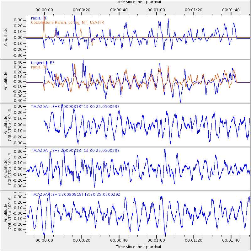
A20A Cobblestone Ranch, Loring, MT, USA - Earthquake Result Viewer
*The percent match for this event was below the threshold and hence no stack was calculated.
| Earthquake location: |
Southwestern Ryukyu Isl., Japan |
| Earthquake latitude/longitude: |
23.5/123.5 |
| Earthquake time(UTC): |
2009/08/18 (230) 13:17:35 GMT |
| Earthquake Depth: |
5.7 km |
| Earthquake Magnitude: |
5.6 MB, 5.2 MS |
| Earthquake Catalog/Contributor: |
WHDF/NEIC |
|
| Network: |
TA USArray Transportable Network (new EarthScope stations) |
| Station: |
A20A Cobblestone Ranch, Loring, MT, USA |
| Lat/Lon: |
48.88 N/107.93 W |
| Elevation: |
868 m |
|
| Distance: |
94.6 deg |
| Az: |
31.189 deg |
| Baz: |
313.936 deg |
| Ray Param: |
$rayparam |
*The percent match for this event was below the threshold and hence was not used in the summary stack. |
|
| Radial Match: |
46.37317 % |
| Radial Bump: |
346 |
| Transverse Match: |
67.8644 % |
| Transverse Bump: |
400 |
| SOD ConfigId: |
2622 |
| Insert Time: |
2010-03-07 00:18:42.522 +0000 |
| GWidth: |
2.5 |
| Max Bumps: |
400 |
| Tol: |
0.001 |
|
Signal To Noise
| Channel | StoN | STA | LTA |
| TA:A20A: :BHZ:20090818T13:30:25.050029Z | 1.905285 | 1.4074527E-7 | 7.3870986E-8 |
| TA:A20A: :BHN:20090818T13:30:25.050029Z | 1.7271758 | 2.8248115E-7 | 1.635509E-7 |
| TA:A20A: :BHE:20090818T13:30:25.050029Z | 0.7140362 | 9.994599E-8 | 1.3997328E-7 |
| Arrivals |
| Ps | |
| PpPs | |
| PsPs/PpSs | |


