You are here: Home > Network List > TA - USArray Transportable Network (new EarthScope stations) Stations List
> Station H31M Peel River, Yukon, CAN > Earthquake Result Viewer
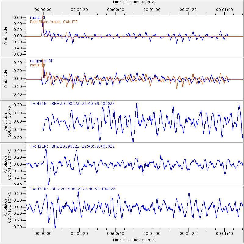
H31M Peel River, Yukon, CAN - Earthquake Result Viewer
*The percent match for this event was below the threshold and hence no stack was calculated.
| Earthquake location: |
Near Coast Of Chiapas, Mexico |
| Earthquake latitude/longitude: |
14.5/-92.8 |
| Earthquake time(UTC): |
2019/06/22 (173) 22:31:38 GMT |
| Earthquake Depth: |
38 km |
| Earthquake Magnitude: |
5.6 Mww |
| Earthquake Catalog/Contributor: |
NEIC PDE/us |
|
| Network: |
TA USArray Transportable Network (new EarthScope stations) |
| Station: |
H31M Peel River, Yukon, CAN |
| Lat/Lon: |
65.81 N/134.34 W |
| Elevation: |
642 m |
|
| Distance: |
58.3 deg |
| Az: |
341.281 deg |
| Baz: |
131.031 deg |
| Ray Param: |
$rayparam |
*The percent match for this event was below the threshold and hence was not used in the summary stack. |
|
| Radial Match: |
58.549313 % |
| Radial Bump: |
400 |
| Transverse Match: |
68.730515 % |
| Transverse Bump: |
400 |
| SOD ConfigId: |
18369291 |
| Insert Time: |
2019-07-06 22:37:29.695 +0000 |
| GWidth: |
2.5 |
| Max Bumps: |
400 |
| Tol: |
0.001 |
|
Signal To Noise
| Channel | StoN | STA | LTA |
| TA:H31M: :BHZ:20190622T22:40:59.40002Z | 3.5159283 | 2.9276057E-7 | 8.326693E-8 |
| TA:H31M: :BHN:20190622T22:40:59.40002Z | 2.5842881 | 1.2981127E-7 | 5.0230955E-8 |
| TA:H31M: :BHE:20190622T22:40:59.40002Z | 2.1111434 | 1.1537647E-7 | 5.4651178E-8 |
| Arrivals |
| Ps | |
| PpPs | |
| PsPs/PpSs | |


