You are here: Home > Network List > TA - USArray Transportable Network (new EarthScope stations) Stations List
> Station I30M Mount Dempster, Yukon, CAN > Earthquake Result Viewer
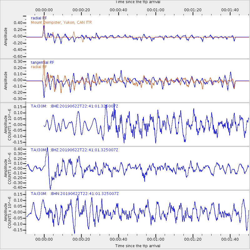
I30M Mount Dempster, Yukon, CAN - Earthquake Result Viewer
*The percent match for this event was below the threshold and hence no stack was calculated.
| Earthquake location: |
Near Coast Of Chiapas, Mexico |
| Earthquake latitude/longitude: |
14.5/-92.8 |
| Earthquake time(UTC): |
2019/06/22 (173) 22:31:38 GMT |
| Earthquake Depth: |
38 km |
| Earthquake Magnitude: |
5.6 Mww |
| Earthquake Catalog/Contributor: |
NEIC PDE/us |
|
| Network: |
TA USArray Transportable Network (new EarthScope stations) |
| Station: |
I30M Mount Dempster, Yukon, CAN |
| Lat/Lon: |
65.22 N/136.38 W |
| Elevation: |
1399 m |
|
| Distance: |
58.6 deg |
| Az: |
340.117 deg |
| Baz: |
128.573 deg |
| Ray Param: |
$rayparam |
*The percent match for this event was below the threshold and hence was not used in the summary stack. |
|
| Radial Match: |
61.175602 % |
| Radial Bump: |
400 |
| Transverse Match: |
71.68649 % |
| Transverse Bump: |
400 |
| SOD ConfigId: |
18369291 |
| Insert Time: |
2019-07-06 22:37:34.967 +0000 |
| GWidth: |
2.5 |
| Max Bumps: |
400 |
| Tol: |
0.001 |
|
Signal To Noise
| Channel | StoN | STA | LTA |
| TA:I30M: :BHZ:20190622T22:41:01.325007Z | 3.9454155 | 2.5495862E-7 | 6.462149E-8 |
| TA:I30M: :BHN:20190622T22:41:01.325007Z | 1.4379965 | 5.2574354E-8 | 3.6560838E-8 |
| TA:I30M: :BHE:20190622T22:41:01.325007Z | 1.9173427 | 8.59148E-8 | 4.480931E-8 |
| Arrivals |
| Ps | |
| PpPs | |
| PsPs/PpSs | |


