You are here: Home > Network List > UW - Pacific Northwest Regional Seismic Network Stations List
> Station UMAT Pilot Rock, OR, USA > Earthquake Result Viewer
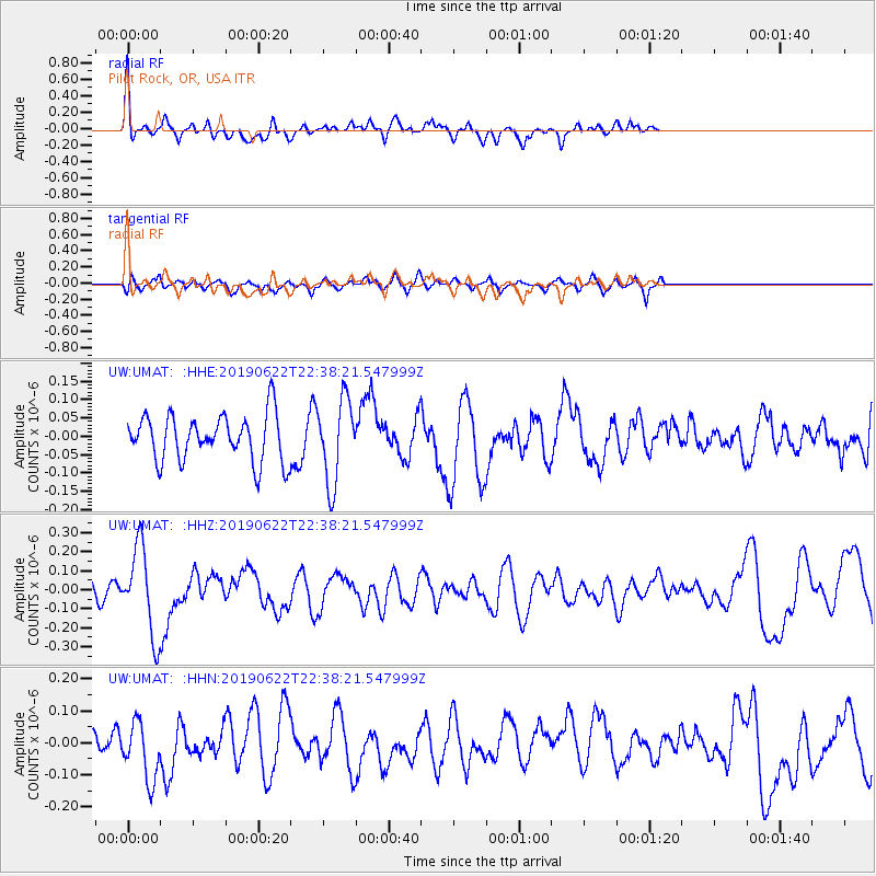
UMAT Pilot Rock, OR, USA - Earthquake Result Viewer
*The percent match for this event was below the threshold and hence no stack was calculated.
| Earthquake location: |
Near Coast Of Chiapas, Mexico |
| Earthquake latitude/longitude: |
14.5/-92.8 |
| Earthquake time(UTC): |
2019/06/22 (173) 22:31:38 GMT |
| Earthquake Depth: |
38 km |
| Earthquake Magnitude: |
5.6 Mww |
| Earthquake Catalog/Contributor: |
NEIC PDE/us |
|
| Network: |
UW Pacific Northwest Regional Seismic Network |
| Station: |
UMAT Pilot Rock, OR, USA |
| Lat/Lon: |
45.29 N/118.96 W |
| Elevation: |
1318 m |
|
| Distance: |
37.9 deg |
| Az: |
329.561 deg |
| Baz: |
135.95 deg |
| Ray Param: |
$rayparam |
*The percent match for this event was below the threshold and hence was not used in the summary stack. |
|
| Radial Match: |
68.769745 % |
| Radial Bump: |
400 |
| Transverse Match: |
55.71674 % |
| Transverse Bump: |
400 |
| SOD ConfigId: |
18369291 |
| Insert Time: |
2019-07-06 22:39:09.268 +0000 |
| GWidth: |
2.5 |
| Max Bumps: |
400 |
| Tol: |
0.001 |
|
Signal To Noise
| Channel | StoN | STA | LTA |
| UW:UMAT: :HHZ:20190622T22:38:21.547999Z | 2.9440372 | 2.281366E-7 | 7.749107E-8 |
| UW:UMAT: :HHN:20190622T22:38:21.547999Z | 1.4296622 | 9.010606E-8 | 6.302612E-8 |
| UW:UMAT: :HHE:20190622T22:38:21.547999Z | 1.8189552 | 1.1431254E-7 | 6.284517E-8 |
| Arrivals |
| Ps | |
| PpPs | |
| PsPs/PpSs | |


