You are here: Home > Network List > TA - USArray Transportable Network (new EarthScope stations) Stations List
> Station C16A Fuhringer Ranch, Dutton, MT, USA > Earthquake Result Viewer
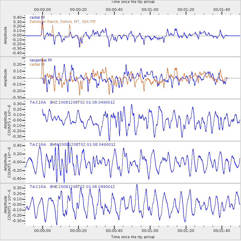
C16A Fuhringer Ranch, Dutton, MT, USA - Earthquake Result Viewer
*The percent match for this event was below the threshold and hence no stack was calculated.
| Earthquake location: |
Northern Mid-Atlantic Ridge |
| Earthquake latitude/longitude: |
13.4/-44.8 |
| Earthquake time(UTC): |
2008/12/08 (343) 01:51:01 GMT |
| Earthquake Depth: |
10 km |
| Earthquake Magnitude: |
5.6 MB, 5.1 MS, 5.5 MW, 5.5 MW |
| Earthquake Catalog/Contributor: |
WHDF/NEIC |
|
| Network: |
TA USArray Transportable Network (new EarthScope stations) |
| Station: |
C16A Fuhringer Ranch, Dutton, MT, USA |
| Lat/Lon: |
47.80 N/111.75 W |
| Elevation: |
1240 m |
|
| Distance: |
64.7 deg |
| Az: |
316.679 deg |
| Baz: |
98.007 deg |
| Ray Param: |
$rayparam |
*The percent match for this event was below the threshold and hence was not used in the summary stack. |
|
| Radial Match: |
59.576622 % |
| Radial Bump: |
400 |
| Transverse Match: |
55.93438 % |
| Transverse Bump: |
400 |
| SOD ConfigId: |
2658 |
| Insert Time: |
2010-03-07 00:24:13.413 +0000 |
| GWidth: |
2.5 |
| Max Bumps: |
400 |
| Tol: |
0.001 |
|
Signal To Noise
| Channel | StoN | STA | LTA |
| TA:C16A: :BHN:20081208T02:01:08.049001Z | 1.9046059 | 1.7701448E-7 | 9.294021E-8 |
| TA:C16A: :BHE:20081208T02:01:08.049001Z | 1.6164868 | 1.5828755E-7 | 9.7920726E-8 |
| TA:C16A: :BHZ:20081208T02:01:08.049001Z | 1.8545763 | 1.5340198E-7 | 8.271538E-8 |
| Arrivals |
| Ps | |
| PpPs | |
| PsPs/PpSs | |


