You are here: Home > Network List > TA - USArray Transportable Network (new EarthScope stations) Stations List
> Station C16A Fuhringer Ranch, Dutton, MT, USA > Earthquake Result Viewer
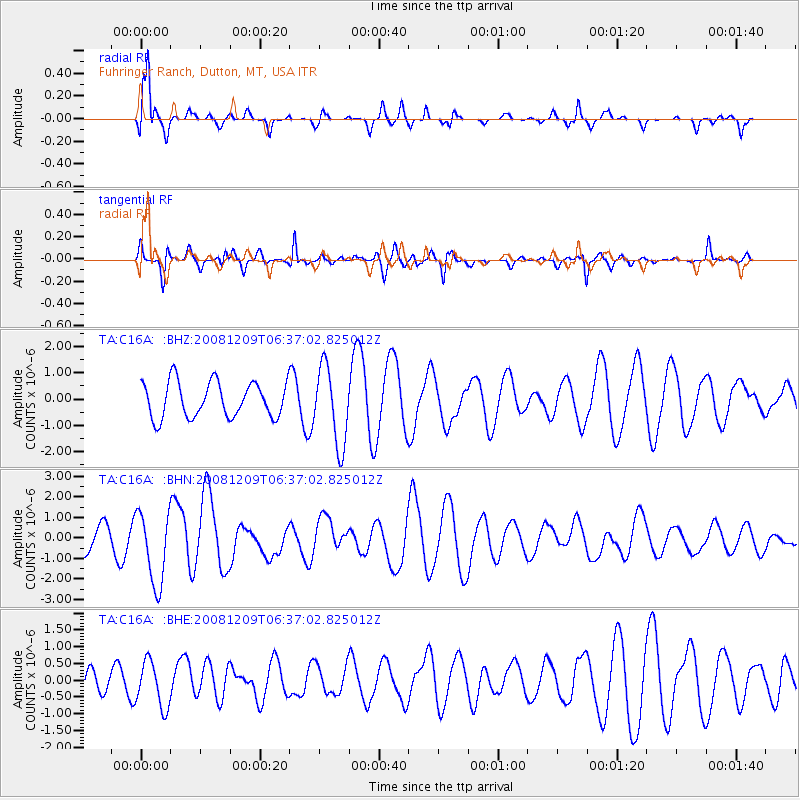
C16A Fuhringer Ranch, Dutton, MT, USA - Earthquake Result Viewer
*The percent match for this event was below the threshold and hence no stack was calculated.
| Earthquake location: |
Kermadec Islands Region |
| Earthquake latitude/longitude: |
-31.2/-176.9 |
| Earthquake time(UTC): |
2008/12/09 (344) 06:23:59 GMT |
| Earthquake Depth: |
18 km |
| Earthquake Magnitude: |
6.2 MB, 6.7 MS, 6.8 MW, 6.7 MW |
| Earthquake Catalog/Contributor: |
WHDF/NEIC |
|
| Network: |
TA USArray Transportable Network (new EarthScope stations) |
| Station: |
C16A Fuhringer Ranch, Dutton, MT, USA |
| Lat/Lon: |
47.80 N/111.75 W |
| Elevation: |
1240 m |
|
| Distance: |
98.0 deg |
| Az: |
38.16 deg |
| Baz: |
231.726 deg |
| Ray Param: |
$rayparam |
*The percent match for this event was below the threshold and hence was not used in the summary stack. |
|
| Radial Match: |
85.0107 % |
| Radial Bump: |
400 |
| Transverse Match: |
80.89455 % |
| Transverse Bump: |
369 |
| SOD ConfigId: |
2658 |
| Insert Time: |
2010-03-07 00:24:14.687 +0000 |
| GWidth: |
2.5 |
| Max Bumps: |
400 |
| Tol: |
0.001 |
|
Signal To Noise
| Channel | StoN | STA | LTA |
| TA:C16A: :BHN:20081209T06:37:02.825012Z | 2.235415 | 1.7768001E-6 | 7.9484124E-7 |
| TA:C16A: :BHE:20081209T06:37:02.825012Z | 0.97012293 | 6.8702445E-7 | 7.081829E-7 |
| TA:C16A: :BHZ:20081209T06:37:02.825012Z | 2.2118392 | 1.4833366E-6 | 6.706349E-7 |
| Arrivals |
| Ps | |
| PpPs | |
| PsPs/PpSs | |


