You are here: Home > Network List > TA - USArray Transportable Network (new EarthScope stations) Stations List
> Station C16A Fuhringer Ranch, Dutton, MT, USA > Earthquake Result Viewer
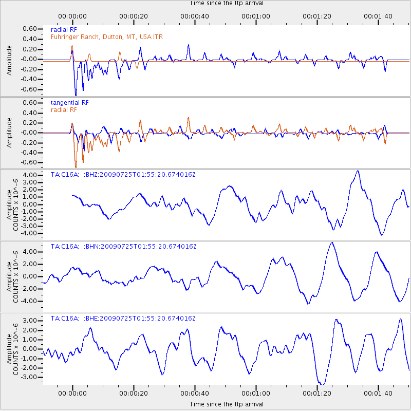
C16A Fuhringer Ranch, Dutton, MT, USA - Earthquake Result Viewer
*The percent match for this event was below the threshold and hence no stack was calculated.
| Earthquake location: |
Solomon Islands |
| Earthquake latitude/longitude: |
-6.5/155.0 |
| Earthquake time(UTC): |
2009/07/25 (206) 01:42:23 GMT |
| Earthquake Depth: |
32 km |
| Earthquake Magnitude: |
5.9 MB, 5.7 MS, 5.9 MW, 5.9 MW |
| Earthquake Catalog/Contributor: |
WHDF/NEIC |
|
| Network: |
TA USArray Transportable Network (new EarthScope stations) |
| Station: |
C16A Fuhringer Ranch, Dutton, MT, USA |
| Lat/Lon: |
47.80 N/111.75 W |
| Elevation: |
1240 m |
|
| Distance: |
97.0 deg |
| Az: |
42.694 deg |
| Baz: |
268.053 deg |
| Ray Param: |
$rayparam |
*The percent match for this event was below the threshold and hence was not used in the summary stack. |
|
| Radial Match: |
64.100426 % |
| Radial Bump: |
400 |
| Transverse Match: |
33.68846 % |
| Transverse Bump: |
312 |
| SOD ConfigId: |
2648 |
| Insert Time: |
2010-03-07 00:24:37.674 +0000 |
| GWidth: |
2.5 |
| Max Bumps: |
400 |
| Tol: |
0.001 |
|
Signal To Noise
| Channel | StoN | STA | LTA |
| TA:C16A: :BHN:20090725T01:55:20.674016Z | 1.9946508 | 1.2142709E-6 | 6.087637E-7 |
| TA:C16A: :BHE:20090725T01:55:20.674016Z | 1.57291 | 7.167762E-7 | 4.557007E-7 |
| TA:C16A: :BHZ:20090725T01:55:20.674016Z | 0.54491425 | 5.138318E-7 | 9.4295905E-7 |
| Arrivals |
| Ps | |
| PpPs | |
| PsPs/PpSs | |


