You are here: Home > Network List > TA - USArray Transportable Network (new EarthScope stations) Stations List
> Station C16A Fuhringer Ranch, Dutton, MT, USA > Earthquake Result Viewer
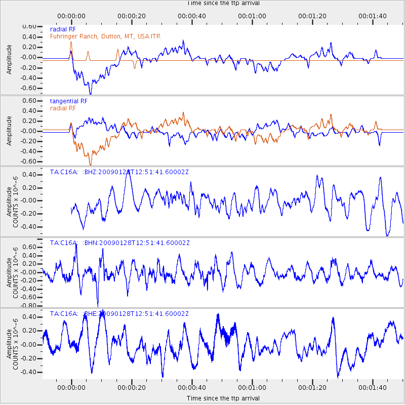
C16A Fuhringer Ranch, Dutton, MT, USA - Earthquake Result Viewer
*The percent match for this event was below the threshold and hence no stack was calculated.
| Earthquake location: |
Samoa Islands Region |
| Earthquake latitude/longitude: |
-17.0/-172.1 |
| Earthquake time(UTC): |
2009/01/28 (028) 12:39:42 GMT |
| Earthquake Depth: |
10 km |
| Earthquake Magnitude: |
5.6 MB, 5.3 MS, 5.5 MW |
| Earthquake Catalog/Contributor: |
WHDF/NEIC |
|
| Network: |
TA USArray Transportable Network (new EarthScope stations) |
| Station: |
C16A Fuhringer Ranch, Dutton, MT, USA |
| Lat/Lon: |
47.80 N/111.75 W |
| Elevation: |
1240 m |
|
| Distance: |
84.0 deg |
| Az: |
36.087 deg |
| Baz: |
236.729 deg |
| Ray Param: |
$rayparam |
*The percent match for this event was below the threshold and hence was not used in the summary stack. |
|
| Radial Match: |
59.601044 % |
| Radial Bump: |
400 |
| Transverse Match: |
54.083996 % |
| Transverse Bump: |
400 |
| SOD ConfigId: |
2658 |
| Insert Time: |
2010-03-07 00:24:43.188 +0000 |
| GWidth: |
2.5 |
| Max Bumps: |
400 |
| Tol: |
0.001 |
|
Signal To Noise
| Channel | StoN | STA | LTA |
| TA:C16A: :BHN:20090128T12:51:41.60002Z | 1.336105 | 2.7896644E-7 | 2.087908E-7 |
| TA:C16A: :BHE:20090128T12:51:41.60002Z | 1.6701257 | 2.843407E-7 | 1.7025107E-7 |
| TA:C16A: :BHZ:20090128T12:51:41.60002Z | 0.6075191 | 1.1823882E-7 | 1.946257E-7 |
| Arrivals |
| Ps | |
| PpPs | |
| PsPs/PpSs | |


