You are here: Home > Network List > CN - Canadian National Seismograph Network Stations List
> Station INK INUVIK, NT > Earthquake Result Viewer
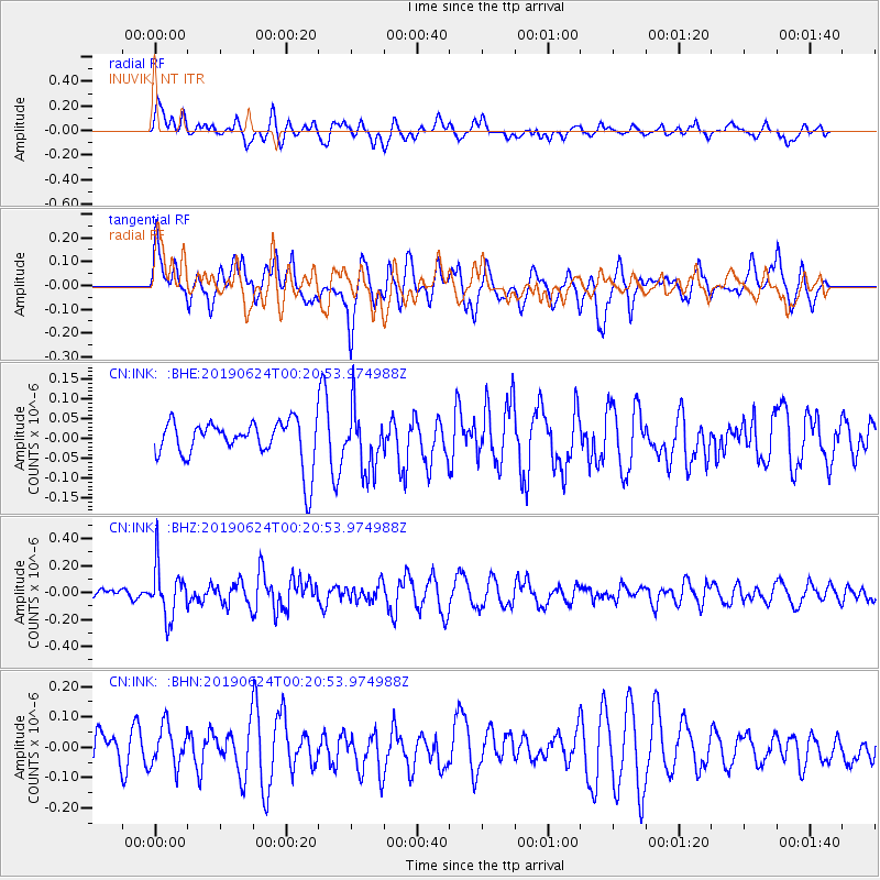
INK INUVIK, NT - Earthquake Result Viewer
*The percent match for this event was below the threshold and hence no stack was calculated.
| Earthquake location: |
Near East Coast Of Honshu, Japan |
| Earthquake latitude/longitude: |
34.9/140.0 |
| Earthquake time(UTC): |
2019/06/24 (175) 00:11:45 GMT |
| Earthquake Depth: |
48 km |
| Earthquake Magnitude: |
5.2 Mww |
| Earthquake Catalog/Contributor: |
NEIC PDE/us |
|
| Network: |
CN Canadian National Seismograph Network |
| Station: |
INK INUVIK, NT |
| Lat/Lon: |
68.31 N/133.53 W |
| Elevation: |
44 m |
|
| Distance: |
56.8 deg |
| Az: |
26.328 deg |
| Baz: |
281.366 deg |
| Ray Param: |
$rayparam |
*The percent match for this event was below the threshold and hence was not used in the summary stack. |
|
| Radial Match: |
35.771114 % |
| Radial Bump: |
400 |
| Transverse Match: |
58.58151 % |
| Transverse Bump: |
400 |
| SOD ConfigId: |
18369291 |
| Insert Time: |
2019-07-08 00:14:46.574 +0000 |
| GWidth: |
2.5 |
| Max Bumps: |
400 |
| Tol: |
0.001 |
|
Signal To Noise
| Channel | StoN | STA | LTA |
| CN:INK: :BHZ:20190624T00:20:53.974988Z | 4.027217 | 1.9138791E-7 | 4.7523617E-8 |
| CN:INK: :BHN:20190624T00:20:53.974988Z | 1.2207462 | 6.880747E-8 | 5.6365096E-8 |
| CN:INK: :BHE:20190624T00:20:53.974988Z | 1.4433501 | 7.49141E-8 | 5.190293E-8 |
| Arrivals |
| Ps | |
| PpPs | |
| PsPs/PpSs | |


