You are here: Home > Network List > TA - USArray Transportable Network (new EarthScope stations) Stations List
> Station C16K Lisburne Hills, AK, USA > Earthquake Result Viewer
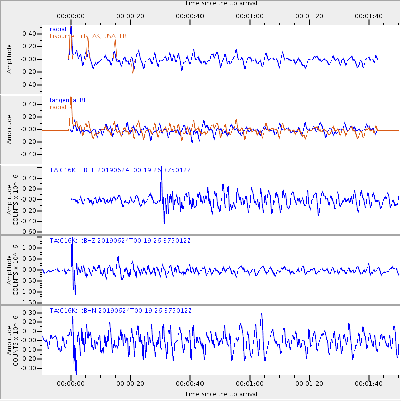
C16K Lisburne Hills, AK, USA - Earthquake Result Viewer
*The percent match for this event was below the threshold and hence no stack was calculated.
| Earthquake location: |
Near East Coast Of Honshu, Japan |
| Earthquake latitude/longitude: |
34.9/140.0 |
| Earthquake time(UTC): |
2019/06/24 (175) 00:11:45 GMT |
| Earthquake Depth: |
48 km |
| Earthquake Magnitude: |
5.2 Mww |
| Earthquake Catalog/Contributor: |
NEIC PDE/us |
|
| Network: |
TA USArray Transportable Network (new EarthScope stations) |
| Station: |
C16K Lisburne Hills, AK, USA |
| Lat/Lon: |
68.27 N/165.34 W |
| Elevation: |
102 m |
|
| Distance: |
45.1 deg |
| Az: |
25.382 deg |
| Baz: |
251.129 deg |
| Ray Param: |
$rayparam |
*The percent match for this event was below the threshold and hence was not used in the summary stack. |
|
| Radial Match: |
77.70151 % |
| Radial Bump: |
400 |
| Transverse Match: |
64.279236 % |
| Transverse Bump: |
400 |
| SOD ConfigId: |
18369291 |
| Insert Time: |
2019-07-08 00:18:43.532 +0000 |
| GWidth: |
2.5 |
| Max Bumps: |
400 |
| Tol: |
0.001 |
|
Signal To Noise
| Channel | StoN | STA | LTA |
| TA:C16K: :BHZ:20190624T00:19:26.375012Z | 7.766232 | 4.4731053E-7 | 5.7596854E-8 |
| TA:C16K: :BHN:20190624T00:19:26.375012Z | 3.2204354 | 1.3664763E-7 | 4.2431413E-8 |
| TA:C16K: :BHE:20190624T00:19:26.375012Z | 4.5522146 | 1.8721843E-7 | 4.1126892E-8 |
| Arrivals |
| Ps | |
| PpPs | |
| PsPs/PpSs | |


