You are here: Home > Network List > TA - USArray Transportable Network (new EarthScope stations) Stations List
> Station F21K Alatna River, AK, USA > Earthquake Result Viewer
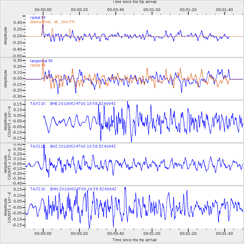
F21K Alatna River, AK, USA - Earthquake Result Viewer
*The percent match for this event was below the threshold and hence no stack was calculated.
| Earthquake location: |
Near East Coast Of Honshu, Japan |
| Earthquake latitude/longitude: |
34.9/140.0 |
| Earthquake time(UTC): |
2019/06/24 (175) 00:11:45 GMT |
| Earthquake Depth: |
48 km |
| Earthquake Magnitude: |
5.2 Mww |
| Earthquake Catalog/Contributor: |
NEIC PDE/us |
|
| Network: |
TA USArray Transportable Network (new EarthScope stations) |
| Station: |
F21K Alatna River, AK, USA |
| Lat/Lon: |
67.22 N/153.48 W |
| Elevation: |
597 m |
|
| Distance: |
49.3 deg |
| Az: |
28.108 deg |
| Baz: |
263.955 deg |
| Ray Param: |
$rayparam |
*The percent match for this event was below the threshold and hence was not used in the summary stack. |
|
| Radial Match: |
54.39426 % |
| Radial Bump: |
400 |
| Transverse Match: |
45.518353 % |
| Transverse Bump: |
400 |
| SOD ConfigId: |
18369291 |
| Insert Time: |
2019-07-08 00:19:03.215 +0000 |
| GWidth: |
2.5 |
| Max Bumps: |
400 |
| Tol: |
0.001 |
|
Signal To Noise
| Channel | StoN | STA | LTA |
| TA:F21K: :BHZ:20190624T00:19:58.824994Z | 4.409924 | 1.4761386E-7 | 3.3473103E-8 |
| TA:F21K: :BHN:20190624T00:19:58.824994Z | 1.3724633 | 5.5738624E-8 | 4.0612104E-8 |
| TA:F21K: :BHE:20190624T00:19:58.824994Z | 2.1422517 | 7.13839E-8 | 3.3321903E-8 |
| Arrivals |
| Ps | |
| PpPs | |
| PsPs/PpSs | |


