You are here: Home > Network List > TA - USArray Transportable Network (new EarthScope stations) Stations List
> Station I17K Unalakleet, AK, USA > Earthquake Result Viewer
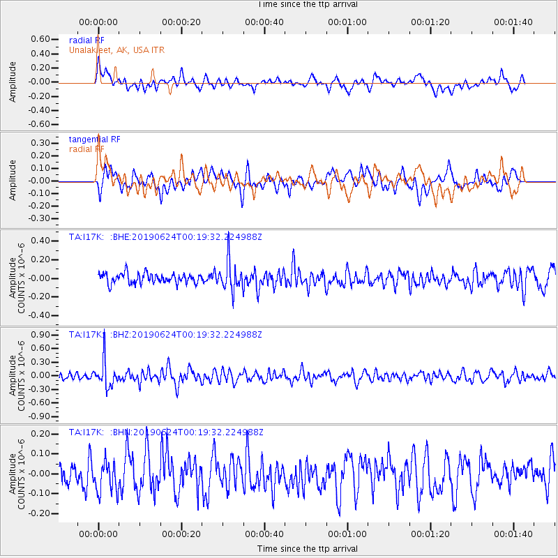
I17K Unalakleet, AK, USA - Earthquake Result Viewer
*The percent match for this event was below the threshold and hence no stack was calculated.
| Earthquake location: |
Near East Coast Of Honshu, Japan |
| Earthquake latitude/longitude: |
34.9/140.0 |
| Earthquake time(UTC): |
2019/06/24 (175) 00:11:45 GMT |
| Earthquake Depth: |
48 km |
| Earthquake Magnitude: |
5.2 Mww |
| Earthquake Catalog/Contributor: |
NEIC PDE/us |
|
| Network: |
TA USArray Transportable Network (new EarthScope stations) |
| Station: |
I17K Unalakleet, AK, USA |
| Lat/Lon: |
63.89 N/160.70 W |
| Elevation: |
105 m |
|
| Distance: |
45.9 deg |
| Az: |
32.029 deg |
| Baz: |
260.04 deg |
| Ray Param: |
$rayparam |
*The percent match for this event was below the threshold and hence was not used in the summary stack. |
|
| Radial Match: |
62.45047 % |
| Radial Bump: |
400 |
| Transverse Match: |
53.50117 % |
| Transverse Bump: |
400 |
| SOD ConfigId: |
18369291 |
| Insert Time: |
2019-07-08 00:19:21.985 +0000 |
| GWidth: |
2.5 |
| Max Bumps: |
400 |
| Tol: |
0.001 |
|
Signal To Noise
| Channel | StoN | STA | LTA |
| TA:I17K: :BHZ:20190624T00:19:32.224988Z | 4.3285036 | 2.909616E-7 | 6.72199E-8 |
| TA:I17K: :BHN:20190624T00:19:32.224988Z | 1.7277976 | 7.864297E-8 | 4.5516305E-8 |
| TA:I17K: :BHE:20190624T00:19:32.224988Z | 2.9763887 | 1.5944597E-7 | 5.357028E-8 |
| Arrivals |
| Ps | |
| PpPs | |
| PsPs/PpSs | |


