You are here: Home > Network List > TA - USArray Transportable Network (new EarthScope stations) Stations List
> Station A14A Double T Ranch, Babb, MT, USA > Earthquake Result Viewer
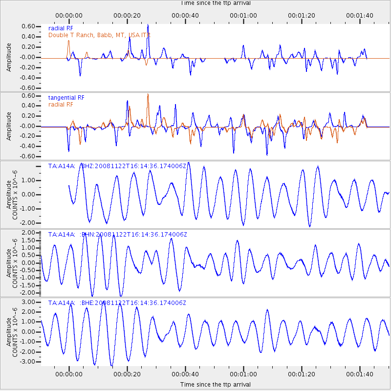
A14A Double T Ranch, Babb, MT, USA - Earthquake Result Viewer
*The percent match for this event was below the threshold and hence no stack was calculated.
| Earthquake location: |
Southeast Of Loyalty Islands |
| Earthquake latitude/longitude: |
-22.5/171.2 |
| Earthquake time(UTC): |
2008/11/22 (327) 16:01:39 GMT |
| Earthquake Depth: |
57 km |
| Earthquake Magnitude: |
5.7 MB, 6.4 MW, 6.4 MW |
| Earthquake Catalog/Contributor: |
WHDF/NEIC |
|
| Network: |
TA USArray Transportable Network (new EarthScope stations) |
| Station: |
A14A Double T Ranch, Babb, MT, USA |
| Lat/Lon: |
48.97 N/113.42 W |
| Elevation: |
1420 m |
|
| Distance: |
97.6 deg |
| Az: |
40.037 deg |
| Baz: |
244.512 deg |
| Ray Param: |
$rayparam |
*The percent match for this event was below the threshold and hence was not used in the summary stack. |
|
| Radial Match: |
82.10234 % |
| Radial Bump: |
352 |
| Transverse Match: |
79.20218 % |
| Transverse Bump: |
377 |
| SOD ConfigId: |
2658 |
| Insert Time: |
2010-03-07 00:27:52.293 +0000 |
| GWidth: |
2.5 |
| Max Bumps: |
400 |
| Tol: |
0.001 |
|
Signal To Noise
| Channel | StoN | STA | LTA |
| TA:A14A: :BHN:20081122T16:14:36.174006Z | 0.85742867 | 9.5111943E-7 | 1.1092694E-6 |
| TA:A14A: :BHE:20081122T16:14:36.174006Z | 2.474738 | 1.8363598E-6 | 7.420421E-7 |
| TA:A14A: :BHZ:20081122T16:14:36.174006Z | 0.40215072 | 4.5958106E-7 | 1.1428081E-6 |
| Arrivals |
| Ps | |
| PpPs | |
| PsPs/PpSs | |


