You are here: Home > Network List > GS - US Geological Survey Networks Stations List
> Station DEC08 Decatur Surface Seismic Site, Decatur, IL, USA > Earthquake Result Viewer
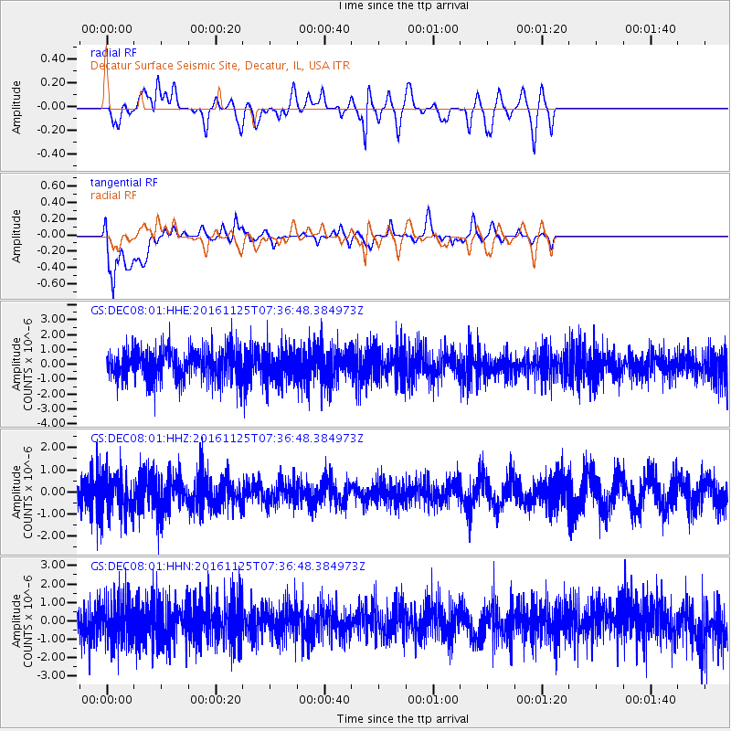
DEC08 Decatur Surface Seismic Site, Decatur, IL, USA - Earthquake Result Viewer
*The percent match for this event was below the threshold and hence no stack was calculated.
| Earthquake location: |
Near East Coast Of Kamchatka |
| Earthquake latitude/longitude: |
54.4/160.6 |
| Earthquake time(UTC): |
2016/11/25 (330) 07:26:23 GMT |
| Earthquake Depth: |
84 km |
| Earthquake Magnitude: |
5.5 MB |
| Earthquake Catalog/Contributor: |
NEIC PDE/NEIC COMCAT |
|
| Network: |
GS US Geological Survey Networks |
| Station: |
DEC08 Decatur Surface Seismic Site, Decatur, IL, USA |
| Lat/Lon: |
39.86 N/88.92 W |
| Elevation: |
210 m |
|
| Distance: |
68.9 deg |
| Az: |
50.614 deg |
| Baz: |
324.081 deg |
| Ray Param: |
$rayparam |
*The percent match for this event was below the threshold and hence was not used in the summary stack. |
|
| Radial Match: |
52.378952 % |
| Radial Bump: |
400 |
| Transverse Match: |
65.19832 % |
| Transverse Bump: |
400 |
| SOD ConfigId: |
1858631 |
| Insert Time: |
2016-12-09 07:27:58.167 +0000 |
| GWidth: |
2.5 |
| Max Bumps: |
400 |
| Tol: |
0.001 |
|
Signal To Noise
| Channel | StoN | STA | LTA |
| GS:DEC08:01:HHZ:20161125T07:36:48.384973Z | 1.5438055 | 8.723917E-7 | 5.650917E-7 |
| GS:DEC08:01:HHN:20161125T07:36:48.384973Z | 1.1069537 | 1.1615979E-6 | 1.0493644E-6 |
| GS:DEC08:01:HHE:20161125T07:36:48.384973Z | 1.0522591 | 1.0914298E-6 | 1.0372253E-6 |
| Arrivals |
| Ps | |
| PpPs | |
| PsPs/PpSs | |


