You are here: Home > Network List > IU - Global Seismograph Network (GSN - IRIS/USGS) Stations List
> Station RSSD Black Hills, South Dakota, USA > Earthquake Result Viewer
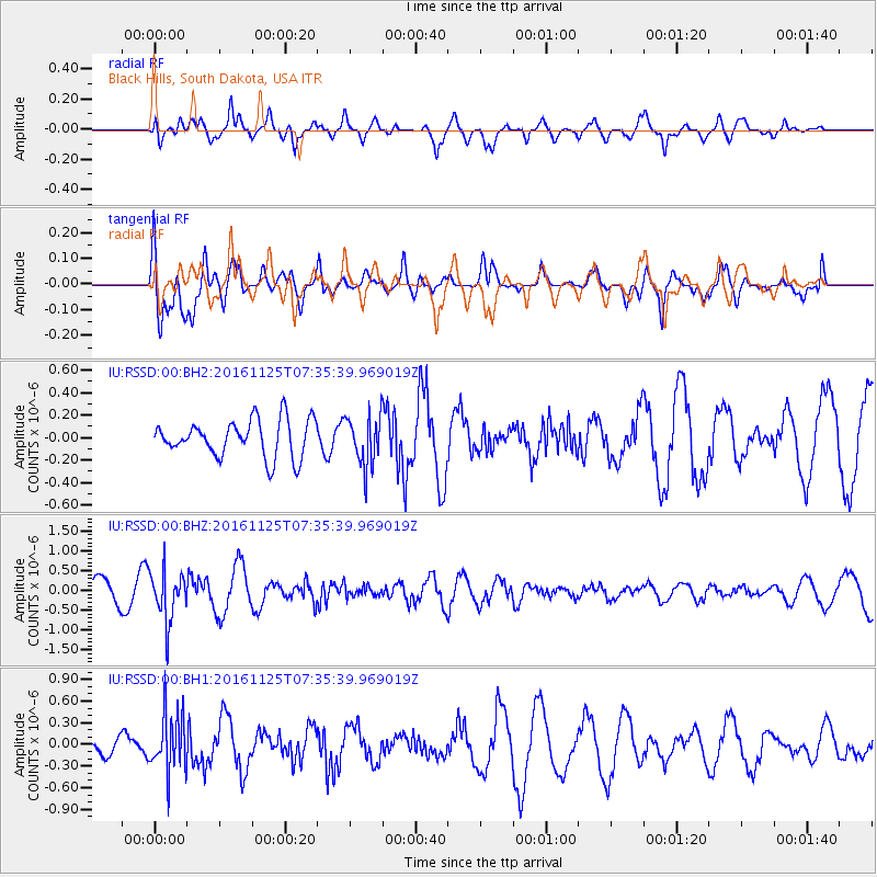
RSSD Black Hills, South Dakota, USA - Earthquake Result Viewer
*The percent match for this event was below the threshold and hence no stack was calculated.
| Earthquake location: |
Near East Coast Of Kamchatka |
| Earthquake latitude/longitude: |
54.4/160.6 |
| Earthquake time(UTC): |
2016/11/25 (330) 07:26:23 GMT |
| Earthquake Depth: |
84 km |
| Earthquake Magnitude: |
5.5 MB |
| Earthquake Catalog/Contributor: |
NEIC PDE/NEIC COMCAT |
|
| Network: |
IU Global Seismograph Network (GSN - IRIS/USGS) |
| Station: |
RSSD Black Hills, South Dakota, USA |
| Lat/Lon: |
44.12 N/104.04 W |
| Elevation: |
2090 m |
|
| Distance: |
58.4 deg |
| Az: |
57.298 deg |
| Baz: |
316.951 deg |
| Ray Param: |
$rayparam |
*The percent match for this event was below the threshold and hence was not used in the summary stack. |
|
| Radial Match: |
71.54812 % |
| Radial Bump: |
400 |
| Transverse Match: |
51.450336 % |
| Transverse Bump: |
400 |
| SOD ConfigId: |
1858631 |
| Insert Time: |
2016-12-09 07:29:05.241 +0000 |
| GWidth: |
2.5 |
| Max Bumps: |
400 |
| Tol: |
0.001 |
|
Signal To Noise
| Channel | StoN | STA | LTA |
| IU:RSSD:00:BHZ:20161125T07:35:39.969019Z | 2.259563 | 6.210304E-7 | 2.7484538E-7 |
| IU:RSSD:00:BH1:20161125T07:35:39.969019Z | 1.924848 | 4.0591712E-7 | 2.1088269E-7 |
| IU:RSSD:00:BH2:20161125T07:35:39.969019Z | 1.3637115 | 2.235089E-7 | 1.638975E-7 |
| Arrivals |
| Ps | |
| PpPs | |
| PsPs/PpSs | |


