You are here: Home > Network List > TA - USArray Transportable Network (new EarthScope stations) Stations List
> Station C15A Salmond Ranch, Choteau, MT, USA > Earthquake Result Viewer
C15A Salmond Ranch, Choteau, MT, USA - Earthquake Result Viewer

| Earthquake location: |
Easter Island Region |
| Earthquake latitude/longitude: |
-28.9/-112.3 |
| Earthquake time(UTC): |
2008/05/31 (152) 23:16:04 GMT |
| Earthquake Depth: |
10 km |
| Earthquake Magnitude: |
5.5 MS, 5.4 MB, 5.8 MW, 5.8 MW |
| Earthquake Catalog/Contributor: |
WHDF/NEIC |
|
| Network: |
TA USArray Transportable Network (new EarthScope stations) |
| Station: |
C15A Salmond Ranch, Choteau, MT, USA |
| Lat/Lon: |
47.78 N/112.61 W |
| Elevation: |
1522 m |
|
| Distance: |
76.3 deg |
| Az: |
359.758 deg |
| Baz: |
179.685 deg |
| Ray Param: |
0.051059775 |
| Estimated Moho Depth: |
55.75 km |
| Estimated Crust Vp/Vs: |
2.00 |
| Assumed Crust Vp: |
6.353 km/s |
| Estimated Crust Vs: |
3.184 km/s |
| Estimated Crust Poisson's Ratio: |
0.33 |
|
| Radial Match: |
80.74634 % |
| Radial Bump: |
400 |
| Transverse Match: |
70.333565 % |
| Transverse Bump: |
400 |
| SOD ConfigId: |
2504 |
| Insert Time: |
2010-03-07 00:31:50.745 +0000 |
| GWidth: |
2.5 |
| Max Bumps: |
400 |
| Tol: |
0.001 |
|
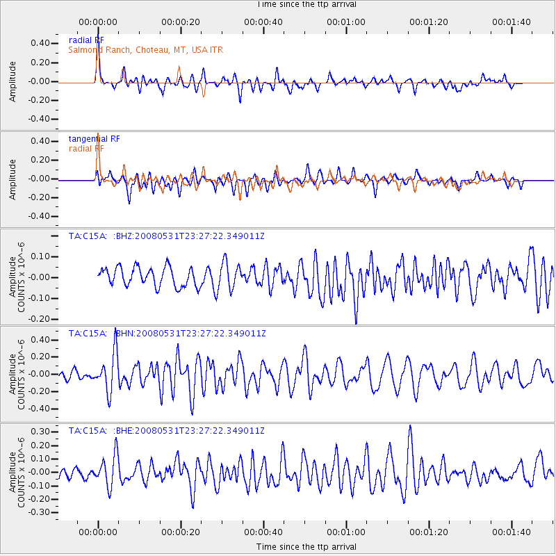
Signal To Noise
| Channel | StoN | STA | LTA |
| TA:C15A: :BHN:20080531T23:27:22.349011Z | 3.901056 | 2.2980761E-7 | 5.8909077E-8 |
| TA:C15A: :BHE:20080531T23:27:22.349011Z | 2.5991263 | 1.1867056E-7 | 4.5657867E-8 |
| TA:C15A: :BHZ:20080531T23:27:22.349011Z | 1.3785143 | 6.076376E-8 | 4.4079165E-8 |
| Arrivals |
| Ps | 9.0 SECOND |
| PpPs | 26 SECOND |
| PsPs/PpSs | 35 SECOND |


