You are here: Home > Network List > TA - USArray Transportable Network (new EarthScope stations) Stations List
> Station C15A Salmond Ranch, Choteau, MT, USA > Earthquake Result Viewer
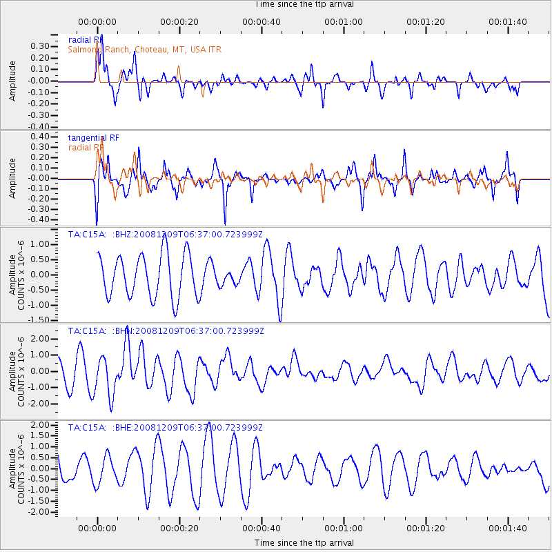
C15A Salmond Ranch, Choteau, MT, USA - Earthquake Result Viewer
*The percent match for this event was below the threshold and hence no stack was calculated.
| Earthquake location: |
Kermadec Islands Region |
| Earthquake latitude/longitude: |
-31.2/-176.9 |
| Earthquake time(UTC): |
2008/12/09 (344) 06:23:59 GMT |
| Earthquake Depth: |
18 km |
| Earthquake Magnitude: |
6.2 MB, 6.7 MS, 6.8 MW, 6.7 MW |
| Earthquake Catalog/Contributor: |
WHDF/NEIC |
|
| Network: |
TA USArray Transportable Network (new EarthScope stations) |
| Station: |
C15A Salmond Ranch, Choteau, MT, USA |
| Lat/Lon: |
47.78 N/112.61 W |
| Elevation: |
1522 m |
|
| Distance: |
97.5 deg |
| Az: |
37.815 deg |
| Baz: |
231.136 deg |
| Ray Param: |
$rayparam |
*The percent match for this event was below the threshold and hence was not used in the summary stack. |
|
| Radial Match: |
79.949425 % |
| Radial Bump: |
399 |
| Transverse Match: |
71.878265 % |
| Transverse Bump: |
347 |
| SOD ConfigId: |
2658 |
| Insert Time: |
2010-03-07 00:33:05.234 +0000 |
| GWidth: |
2.5 |
| Max Bumps: |
400 |
| Tol: |
0.001 |
|
Signal To Noise
| Channel | StoN | STA | LTA |
| TA:C15A: :BHN:20081209T06:37:00.723999Z | 2.0169976 | 1.181934E-6 | 5.8598687E-7 |
| TA:C15A: :BHE:20081209T06:37:00.723999Z | 0.68530375 | 6.3073554E-7 | 9.203737E-7 |
| TA:C15A: :BHZ:20081209T06:37:00.723999Z | 0.33823463 | 2.399496E-7 | 7.094176E-7 |
| Arrivals |
| Ps | |
| PpPs | |
| PsPs/PpSs | |


