You are here: Home > Network List > TA - USArray Transportable Network (new EarthScope stations) Stations List
> Station C15A Salmond Ranch, Choteau, MT, USA > Earthquake Result Viewer
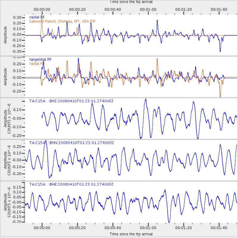
C15A Salmond Ranch, Choteau, MT, USA - Earthquake Result Viewer
*The percent match for this event was below the threshold and hence no stack was calculated.
| Earthquake location: |
Loyalty Islands |
| Earthquake latitude/longitude: |
-20.3/168.9 |
| Earthquake time(UTC): |
2008/04/10 (101) 01:10:02 GMT |
| Earthquake Depth: |
35 km |
| Earthquake Magnitude: |
5.5 MB, 5.5 MS, 5.8 MW |
| Earthquake Catalog/Contributor: |
WHDF/NEIC |
|
| Network: |
TA USArray Transportable Network (new EarthScope stations) |
| Station: |
C15A Salmond Ranch, Choteau, MT, USA |
| Lat/Lon: |
47.78 N/112.61 W |
| Elevation: |
1522 m |
|
| Distance: |
97.4 deg |
| Az: |
41.788 deg |
| Baz: |
247.991 deg |
| Ray Param: |
$rayparam |
*The percent match for this event was below the threshold and hence was not used in the summary stack. |
|
| Radial Match: |
46.8004 % |
| Radial Bump: |
308 |
| Transverse Match: |
48.839817 % |
| Transverse Bump: |
367 |
| SOD ConfigId: |
2504 |
| Insert Time: |
2010-03-07 00:33:40.714 +0000 |
| GWidth: |
2.5 |
| Max Bumps: |
400 |
| Tol: |
0.001 |
|
Signal To Noise
| Channel | StoN | STA | LTA |
| TA:C15A: :BHN:20080410T01:23:01.274006Z | 2.0948443 | 1.8904026E-7 | 9.024072E-8 |
| TA:C15A: :BHE:20080410T01:23:01.274006Z | 0.42669025 | 5.035371E-8 | 1.1800998E-7 |
| TA:C15A: :BHZ:20080410T01:23:01.274006Z | 1.7704929 | 9.637288E-8 | 5.44328E-8 |
| Arrivals |
| Ps | |
| PpPs | |
| PsPs/PpSs | |


