You are here: Home > Network List > TA - USArray Transportable Network (new EarthScope stations) Stations List
> Station C15A Salmond Ranch, Choteau, MT, USA > Earthquake Result Viewer
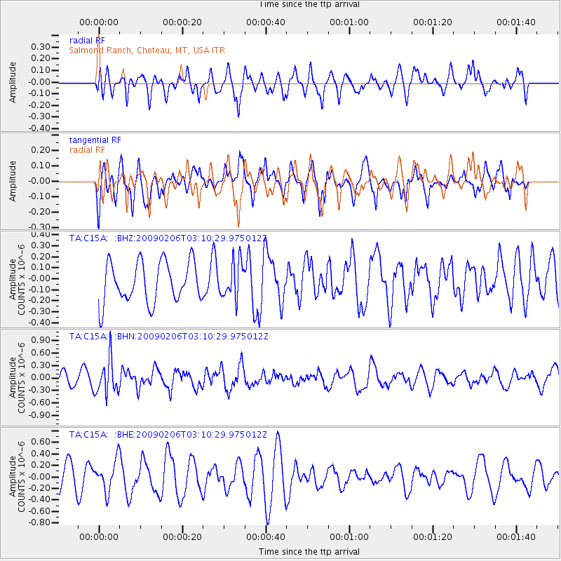
C15A Salmond Ranch, Choteau, MT, USA - Earthquake Result Viewer
*The percent match for this event was below the threshold and hence no stack was calculated.
| Earthquake location: |
Near Coast Of Northern Chile |
| Earthquake latitude/longitude: |
-28.0/-71.1 |
| Earthquake time(UTC): |
2009/02/06 (037) 02:58:35 GMT |
| Earthquake Depth: |
52 km |
| Earthquake Magnitude: |
5.5 MB |
| Earthquake Catalog/Contributor: |
WHDF/NEIC |
|
| Network: |
TA USArray Transportable Network (new EarthScope stations) |
| Station: |
C15A Salmond Ranch, Choteau, MT, USA |
| Lat/Lon: |
47.78 N/112.61 W |
| Elevation: |
1522 m |
|
| Distance: |
84.1 deg |
| Az: |
333.3 deg |
| Baz: |
143.906 deg |
| Ray Param: |
$rayparam |
*The percent match for this event was below the threshold and hence was not used in the summary stack. |
|
| Radial Match: |
43.73728 % |
| Radial Bump: |
400 |
| Transverse Match: |
39.238285 % |
| Transverse Bump: |
389 |
| SOD ConfigId: |
2658 |
| Insert Time: |
2010-03-07 00:33:49.649 +0000 |
| GWidth: |
2.5 |
| Max Bumps: |
400 |
| Tol: |
0.001 |
|
Signal To Noise
| Channel | StoN | STA | LTA |
| TA:C15A: :BHN:20090206T03:10:29.975012Z | 2.1043613 | 4.1020022E-7 | 1.949286E-7 |
| TA:C15A: :BHE:20090206T03:10:29.975012Z | 1.2945962 | 2.7586074E-7 | 2.1308632E-7 |
| TA:C15A: :BHZ:20090206T03:10:29.975012Z | 0.9137886 | 1.6832277E-7 | 1.8420317E-7 |
| Arrivals |
| Ps | |
| PpPs | |
| PsPs/PpSs | |


