You are here: Home > Network List > TA - USArray Transportable Network (new EarthScope stations) Stations List
> Station C15A Salmond Ranch, Choteau, MT, USA > Earthquake Result Viewer
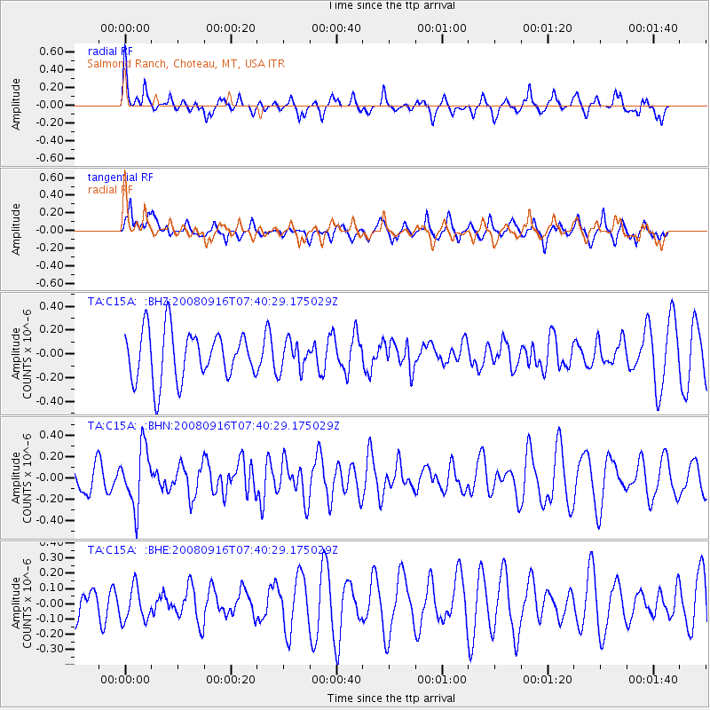
C15A Salmond Ranch, Choteau, MT, USA - Earthquake Result Viewer
*The percent match for this event was below the threshold and hence no stack was calculated.
| Earthquake location: |
Central Mid-Atlantic Ridge |
| Earthquake latitude/longitude: |
0.9/-29.0 |
| Earthquake time(UTC): |
2008/09/16 (260) 07:28:25 GMT |
| Earthquake Depth: |
10 km |
| Earthquake Magnitude: |
5.8 MW, 5.2 MS, 5.2 MB, 5.8 MW |
| Earthquake Catalog/Contributor: |
WHDF/NEIC |
|
| Network: |
TA USArray Transportable Network (new EarthScope stations) |
| Station: |
C15A Salmond Ranch, Choteau, MT, USA |
| Lat/Lon: |
47.78 N/112.61 W |
| Elevation: |
1522 m |
|
| Distance: |
85.0 deg |
| Az: |
317.712 deg |
| Baz: |
94.122 deg |
| Ray Param: |
$rayparam |
*The percent match for this event was below the threshold and hence was not used in the summary stack. |
|
| Radial Match: |
75.42833 % |
| Radial Bump: |
400 |
| Transverse Match: |
64.187256 % |
| Transverse Bump: |
390 |
| SOD ConfigId: |
2560 |
| Insert Time: |
2010-03-07 00:34:05.287 +0000 |
| GWidth: |
2.5 |
| Max Bumps: |
400 |
| Tol: |
0.001 |
|
Signal To Noise
| Channel | StoN | STA | LTA |
| TA:C15A: :BHN:20080916T07:40:29.175029Z | 1.6363977 | 2.7438372E-7 | 1.6767545E-7 |
| TA:C15A: :BHE:20080916T07:40:29.175029Z | 0.8865776 | 1.12008E-7 | 1.2633751E-7 |
| TA:C15A: :BHZ:20080916T07:40:29.175029Z | 0.57504964 | 1.1957188E-7 | 2.0793314E-7 |
| Arrivals |
| Ps | |
| PpPs | |
| PsPs/PpSs | |


