You are here: Home > Network List > AV - Alaska Volcano Observatory Stations List
> Station MAPS Pakushin Southeast, Makushin Volcano, Alaska > Earthquake Result Viewer
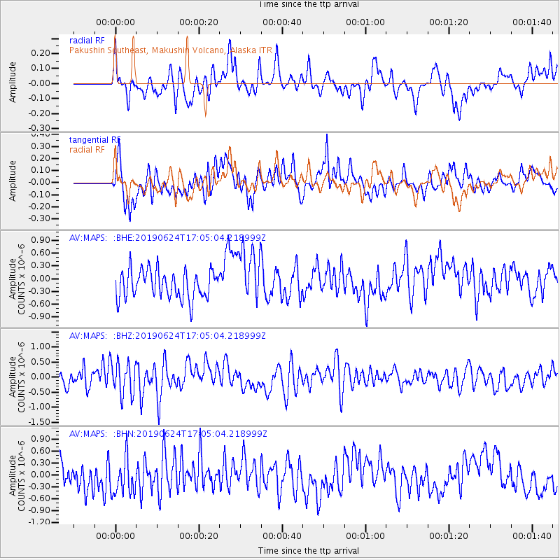
MAPS Pakushin Southeast, Makushin Volcano, Alaska - Earthquake Result Viewer
*The percent match for this event was below the threshold and hence no stack was calculated.
| Earthquake location: |
Irian Jaya, Indonesia |
| Earthquake latitude/longitude: |
-2.7/138.4 |
| Earthquake time(UTC): |
2019/06/24 (175) 16:54:11 GMT |
| Earthquake Depth: |
19 km |
| Earthquake Magnitude: |
5.7 mb |
| Earthquake Catalog/Contributor: |
NEIC PDE/us |
|
| Network: |
AV Alaska Volcano Observatory |
| Station: |
MAPS Pakushin Southeast, Makushin Volcano, Alaska |
| Lat/Lon: |
53.81 N/166.94 W |
| Elevation: |
333 m |
|
| Distance: |
72.2 deg |
| Az: |
30.536 deg |
| Baz: |
238.847 deg |
| Ray Param: |
$rayparam |
*The percent match for this event was below the threshold and hence was not used in the summary stack. |
|
| Radial Match: |
50.335743 % |
| Radial Bump: |
400 |
| Transverse Match: |
59.467827 % |
| Transverse Bump: |
400 |
| SOD ConfigId: |
18369291 |
| Insert Time: |
2019-07-08 16:57:59.543 +0000 |
| GWidth: |
2.5 |
| Max Bumps: |
400 |
| Tol: |
0.001 |
|
Signal To Noise
| Channel | StoN | STA | LTA |
| AV:MAPS: :BHZ:20190624T17:05:04.218999Z | 1.8321371 | 5.2168195E-7 | 2.8473957E-7 |
| AV:MAPS: :BHN:20190624T17:05:04.218999Z | 1.3788077 | 4.6104762E-7 | 3.3438138E-7 |
| AV:MAPS: :BHE:20190624T17:05:04.218999Z | 2.0802276 | 6.762918E-7 | 3.251047E-7 |
| Arrivals |
| Ps | |
| PpPs | |
| PsPs/PpSs | |


