You are here: Home > Network List > G - GEOSCOPE Stations List
> Station PPTF Pamatai - Papeete - Tahiti island - French Polynesia, France > Earthquake Result Viewer
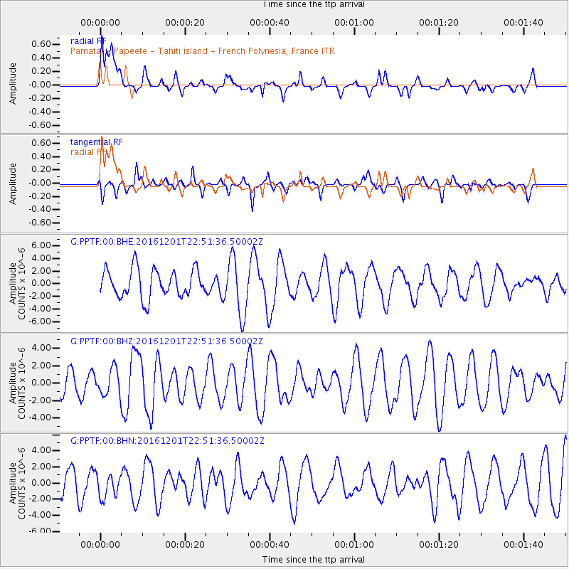
PPTF Pamatai - Papeete - Tahiti island - French Polynesia, France - Earthquake Result Viewer
*The percent match for this event was below the threshold and hence no stack was calculated.
| Earthquake location: |
Southern Peru |
| Earthquake latitude/longitude: |
-15.3/-70.8 |
| Earthquake time(UTC): |
2016/12/01 (336) 22:40:26 GMT |
| Earthquake Depth: |
10 km |
| Earthquake Magnitude: |
6.3 Mww |
| Earthquake Catalog/Contributor: |
NEIC PDE/us |
|
| Network: |
G GEOSCOPE |
| Station: |
PPTF Pamatai - Papeete - Tahiti island - French Polynesia, France |
| Lat/Lon: |
17.59 S/149.57 W |
| Elevation: |
705 m |
|
| Distance: |
75.0 deg |
| Az: |
255.558 deg |
| Baz: |
101.578 deg |
| Ray Param: |
$rayparam |
*The percent match for this event was below the threshold and hence was not used in the summary stack. |
|
| Radial Match: |
44.85251 % |
| Radial Bump: |
400 |
| Transverse Match: |
54.418686 % |
| Transverse Bump: |
400 |
| SOD ConfigId: |
1894071 |
| Insert Time: |
2016-12-15 22:43:38.078 +0000 |
| GWidth: |
2.5 |
| Max Bumps: |
400 |
| Tol: |
0.001 |
|
Signal To Noise
| Channel | StoN | STA | LTA |
| G:PPTF:00:BHZ:20161201T22:51:36.50002Z | 0.8392017 | 1.544611E-6 | 1.8405717E-6 |
| G:PPTF:00:BHN:20161201T22:51:36.50002Z | 0.9428857 | 1.4485875E-6 | 1.536334E-6 |
| G:PPTF:00:BHE:20161201T22:51:36.50002Z | 2.048708 | 4.492503E-6 | 2.192847E-6 |
| Arrivals |
| Ps | |
| PpPs | |
| PsPs/PpSs | |


