You are here: Home > Network List > GS - US Geological Survey Networks Stations List
> Station KAN10 Keim Farm > Earthquake Result Viewer
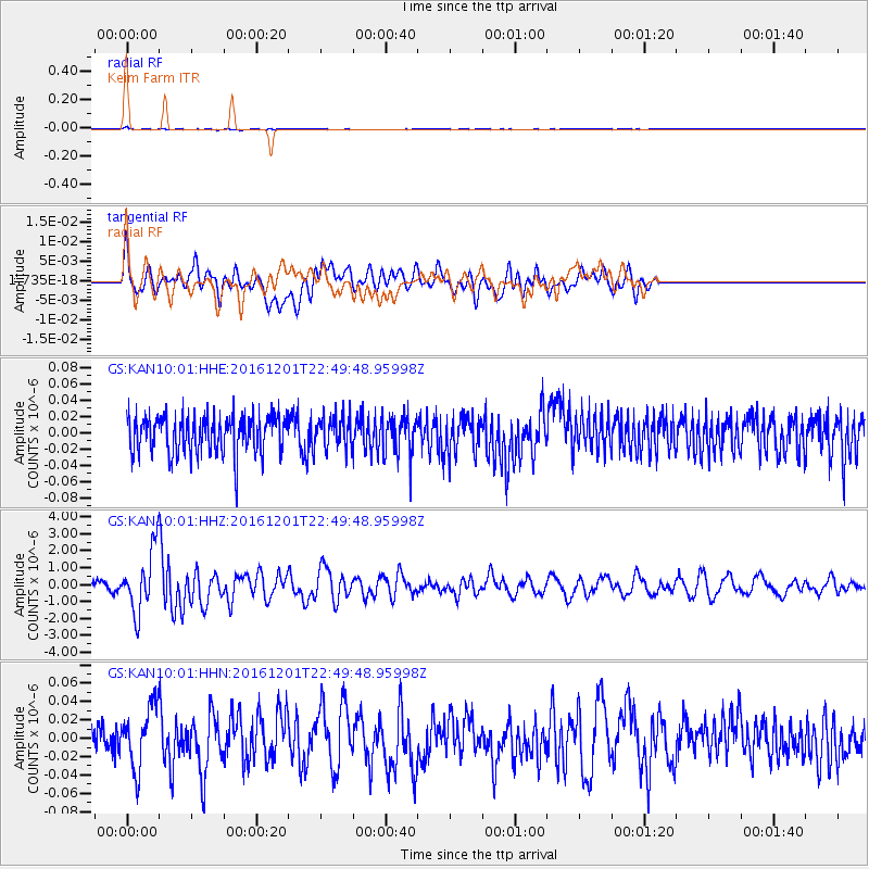
KAN10 Keim Farm - Earthquake Result Viewer
*The percent match for this event was below the threshold and hence no stack was calculated.
| Earthquake location: |
Southern Peru |
| Earthquake latitude/longitude: |
-15.3/-70.8 |
| Earthquake time(UTC): |
2016/12/01 (336) 22:40:26 GMT |
| Earthquake Depth: |
10 km |
| Earthquake Magnitude: |
6.3 Mww |
| Earthquake Catalog/Contributor: |
NEIC PDE/us |
|
| Network: |
GS US Geological Survey Networks |
| Station: |
KAN10 Keim Farm |
| Lat/Lon: |
37.12 N/98.10 W |
| Elevation: |
417 m |
|
| Distance: |
58.1 deg |
| Az: |
334.458 deg |
| Baz: |
148.633 deg |
| Ray Param: |
$rayparam |
*The percent match for this event was below the threshold and hence was not used in the summary stack. |
|
| Radial Match: |
73.30418 % |
| Radial Bump: |
400 |
| Transverse Match: |
60.862717 % |
| Transverse Bump: |
400 |
| SOD ConfigId: |
1894071 |
| Insert Time: |
2016-12-15 22:43:59.820 +0000 |
| GWidth: |
2.5 |
| Max Bumps: |
400 |
| Tol: |
0.001 |
|
Signal To Noise
| Channel | StoN | STA | LTA |
| GS:KAN10:01:HHZ:20161201T22:49:48.95998Z | 9.373788 | 1.7888394E-6 | 1.908342E-7 |
| GS:KAN10:01:HHN:20161201T22:49:48.95998Z | 1.705504 | 3.371026E-8 | 1.9765572E-8 |
| GS:KAN10:01:HHE:20161201T22:49:48.95998Z | 0.8441364 | 1.943501E-8 | 2.3023542E-8 |
| Arrivals |
| Ps | |
| PpPs | |
| PsPs/PpSs | |


