You are here: Home > Network List > GS - US Geological Survey Networks Stations List
> Station KAN13 Rinehart Farm > Earthquake Result Viewer
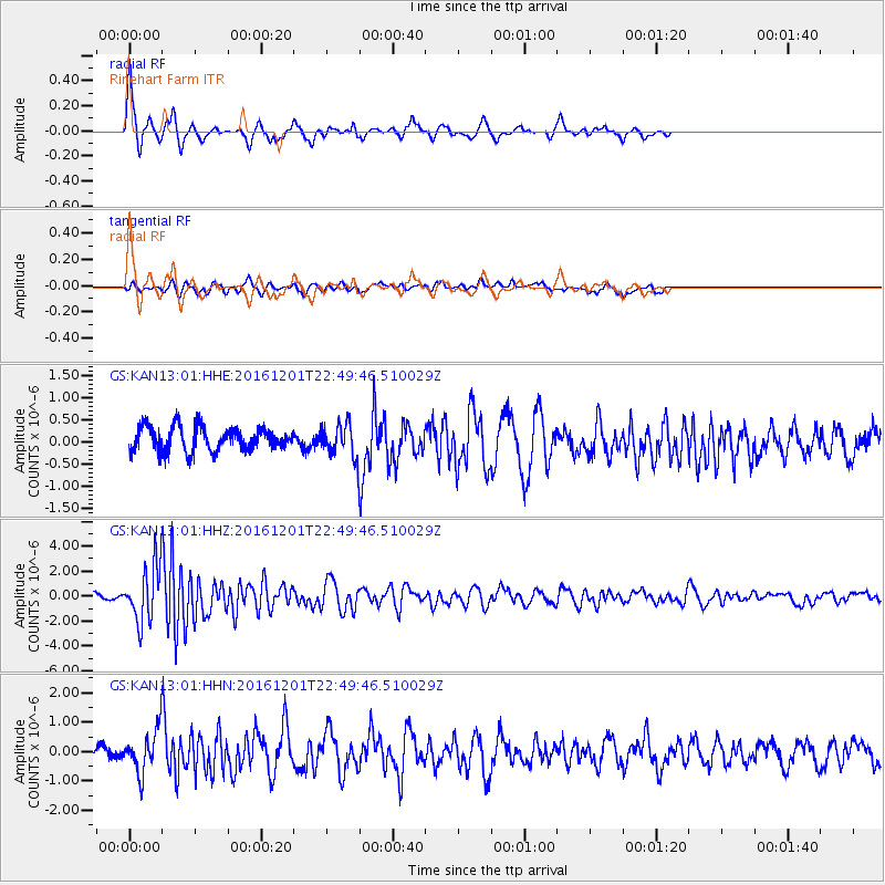
KAN13 Rinehart Farm - Earthquake Result Viewer
*The percent match for this event was below the threshold and hence no stack was calculated.
| Earthquake location: |
Southern Peru |
| Earthquake latitude/longitude: |
-15.3/-70.8 |
| Earthquake time(UTC): |
2016/12/01 (336) 22:40:26 GMT |
| Earthquake Depth: |
10 km |
| Earthquake Magnitude: |
6.3 Mww |
| Earthquake Catalog/Contributor: |
NEIC PDE/us |
|
| Network: |
GS US Geological Survey Networks |
| Station: |
KAN13 Rinehart Farm |
| Lat/Lon: |
37.01 N/97.48 W |
| Elevation: |
340 m |
|
| Distance: |
57.8 deg |
| Az: |
334.89 deg |
| Baz: |
149.232 deg |
| Ray Param: |
$rayparam |
*The percent match for this event was below the threshold and hence was not used in the summary stack. |
|
| Radial Match: |
79.76808 % |
| Radial Bump: |
225 |
| Transverse Match: |
31.365759 % |
| Transverse Bump: |
293 |
| SOD ConfigId: |
1894071 |
| Insert Time: |
2016-12-15 22:44:02.260 +0000 |
| GWidth: |
2.5 |
| Max Bumps: |
400 |
| Tol: |
0.001 |
|
Signal To Noise
| Channel | StoN | STA | LTA |
| GS:KAN13:01:HHZ:20161201T22:49:46.510029Z | 10.182032 | 2.173285E-6 | 2.1344316E-7 |
| GS:KAN13:01:HHN:20161201T22:49:46.510029Z | 2.157906 | 6.906826E-7 | 3.2007077E-7 |
| GS:KAN13:01:HHE:20161201T22:49:46.510029Z | 1.311093 | 3.561823E-7 | 2.7166823E-7 |
| Arrivals |
| Ps | |
| PpPs | |
| PsPs/PpSs | |


