You are here: Home > Network List > TA - USArray Transportable Network (new EarthScope stations) Stations List
> Station B17A L&G Farms, Chester, MT, USA > Earthquake Result Viewer
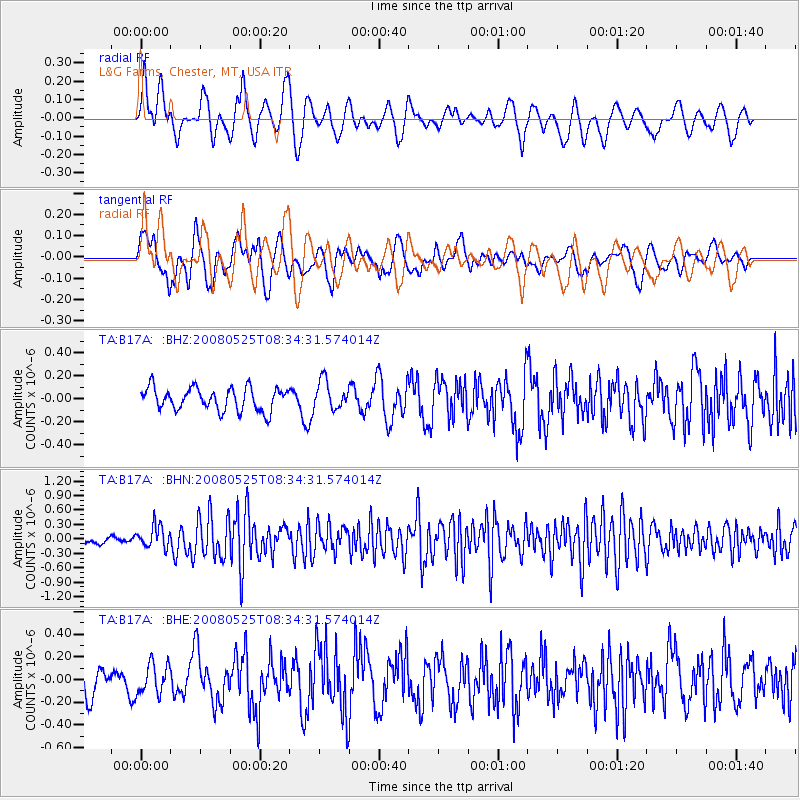
B17A L&G Farms, Chester, MT, USA - Earthquake Result Viewer
*The percent match for this event was below the threshold and hence no stack was calculated.
| Earthquake location: |
Sichuan, China |
| Earthquake latitude/longitude: |
32.6/105.4 |
| Earthquake time(UTC): |
2008/05/25 (146) 08:21:48 GMT |
| Earthquake Depth: |
10 km |
| Earthquake Magnitude: |
5.8 MB, 6.0 MS, 6.0 MW, 6.0 MW |
| Earthquake Catalog/Contributor: |
WHDF/NEIC |
|
| Network: |
TA USArray Transportable Network (new EarthScope stations) |
| Station: |
B17A L&G Farms, Chester, MT, USA |
| Lat/Lon: |
48.29 N/110.80 W |
| Elevation: |
894 m |
|
| Distance: |
93.2 deg |
| Az: |
23.282 deg |
| Baz: |
330.017 deg |
| Ray Param: |
$rayparam |
*The percent match for this event was below the threshold and hence was not used in the summary stack. |
|
| Radial Match: |
69.53262 % |
| Radial Bump: |
400 |
| Transverse Match: |
55.55418 % |
| Transverse Bump: |
400 |
| SOD ConfigId: |
2504 |
| Insert Time: |
2010-03-07 00:40:08.408 +0000 |
| GWidth: |
2.5 |
| Max Bumps: |
400 |
| Tol: |
0.001 |
|
Signal To Noise
| Channel | StoN | STA | LTA |
| TA:B17A: :BHN:20080525T08:34:31.574014Z | 2.6280937 | 2.327552E-7 | 8.856427E-8 |
| TA:B17A: :BHE:20080525T08:34:31.574014Z | 0.9109344 | 1.336517E-7 | 1.4671934E-7 |
| TA:B17A: :BHZ:20080525T08:34:31.574014Z | 1.2450949 | 1.2175794E-7 | 9.7790085E-8 |
| Arrivals |
| Ps | |
| PpPs | |
| PsPs/PpSs | |


