You are here: Home > Network List > TA - USArray Transportable Network (new EarthScope stations) Stations List
> Station B17A L&G Farms, Chester, MT, USA > Earthquake Result Viewer
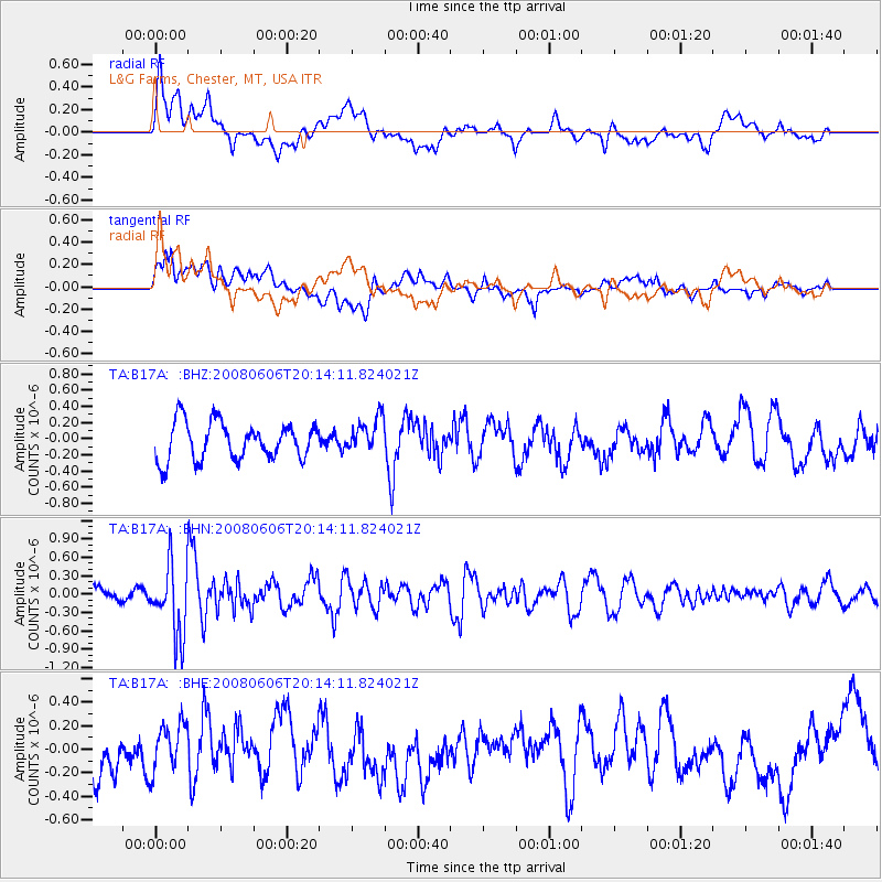
B17A L&G Farms, Chester, MT, USA - Earthquake Result Viewer
*The percent match for this event was below the threshold and hence no stack was calculated.
| Earthquake location: |
Northern Algeria |
| Earthquake latitude/longitude: |
35.9/-0.7 |
| Earthquake time(UTC): |
2008/06/06 (158) 20:02:56 GMT |
| Earthquake Depth: |
4.0 km |
| Earthquake Magnitude: |
5.5 MB, 5.3 MS, 5.5 MW, 5.5 MW |
| Earthquake Catalog/Contributor: |
WHDF/NEIC |
|
| Network: |
TA USArray Transportable Network (new EarthScope stations) |
| Station: |
B17A L&G Farms, Chester, MT, USA |
| Lat/Lon: |
48.29 N/110.80 W |
| Elevation: |
894 m |
|
| Distance: |
75.7 deg |
| Az: |
319.674 deg |
| Baz: |
51.899 deg |
| Ray Param: |
$rayparam |
*The percent match for this event was below the threshold and hence was not used in the summary stack. |
|
| Radial Match: |
64.81985 % |
| Radial Bump: |
400 |
| Transverse Match: |
44.679104 % |
| Transverse Bump: |
400 |
| SOD ConfigId: |
2504 |
| Insert Time: |
2010-03-07 00:40:13.932 +0000 |
| GWidth: |
2.5 |
| Max Bumps: |
400 |
| Tol: |
0.001 |
|
Signal To Noise
| Channel | StoN | STA | LTA |
| TA:B17A: :BHN:20080606T20:14:11.824021Z | 3.0978944 | 5.727852E-7 | 1.84895E-7 |
| TA:B17A: :BHE:20080606T20:14:11.824021Z | 1.2785289 | 2.0675856E-7 | 1.6171599E-7 |
| TA:B17A: :BHZ:20080606T20:14:11.824021Z | 0.93928796 | 2.1686706E-7 | 2.3088454E-7 |
| Arrivals |
| Ps | |
| PpPs | |
| PsPs/PpSs | |


