You are here: Home > Network List > US - United States National Seismic Network Stations List
> Station DGMT Dagmar, Montana, USA > Earthquake Result Viewer
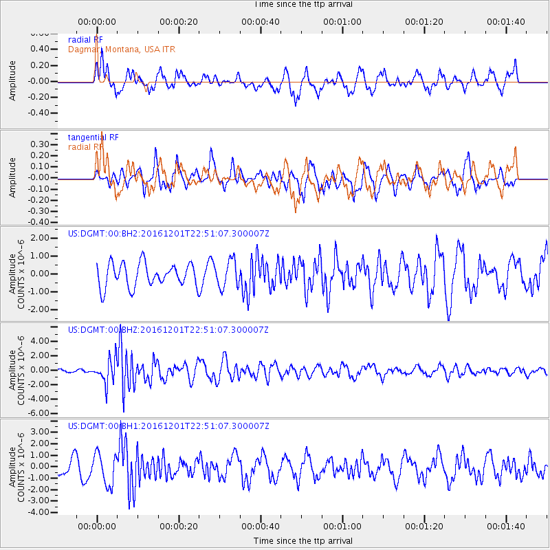
DGMT Dagmar, Montana, USA - Earthquake Result Viewer
*The percent match for this event was below the threshold and hence no stack was calculated.
| Earthquake location: |
Southern Peru |
| Earthquake latitude/longitude: |
-15.3/-70.8 |
| Earthquake time(UTC): |
2016/12/01 (336) 22:40:26 GMT |
| Earthquake Depth: |
10 km |
| Earthquake Magnitude: |
6.3 Mww |
| Earthquake Catalog/Contributor: |
NEIC PDE/us |
|
| Network: |
US United States National Seismic Network |
| Station: |
DGMT Dagmar, Montana, USA |
| Lat/Lon: |
48.47 N/104.20 W |
| Elevation: |
0.0 m |
|
| Distance: |
70.1 deg |
| Az: |
337.088 deg |
| Baz: |
145.635 deg |
| Ray Param: |
$rayparam |
*The percent match for this event was below the threshold and hence was not used in the summary stack. |
|
| Radial Match: |
62.30211 % |
| Radial Bump: |
400 |
| Transverse Match: |
57.12054 % |
| Transverse Bump: |
334 |
| SOD ConfigId: |
1894071 |
| Insert Time: |
2016-12-15 22:46:52.535 +0000 |
| GWidth: |
2.5 |
| Max Bumps: |
400 |
| Tol: |
0.001 |
|
Signal To Noise
| Channel | StoN | STA | LTA |
| US:DGMT:00:BHZ:20161201T22:51:07.300007Z | 7.4715767 | 1.7650414E-6 | 2.3623411E-7 |
| US:DGMT:00:BH1:20161201T22:51:07.300007Z | 1.7502961 | 1.3996834E-6 | 7.996838E-7 |
| US:DGMT:00:BH2:20161201T22:51:07.300007Z | 1.1659629 | 7.6506126E-7 | 6.561626E-7 |
| Arrivals |
| Ps | |
| PpPs | |
| PsPs/PpSs | |


