You are here: Home > Network List > US - United States National Seismic Network Stations List
> Station WMOK Wichita Mountains, Oklahoma, USA > Earthquake Result Viewer
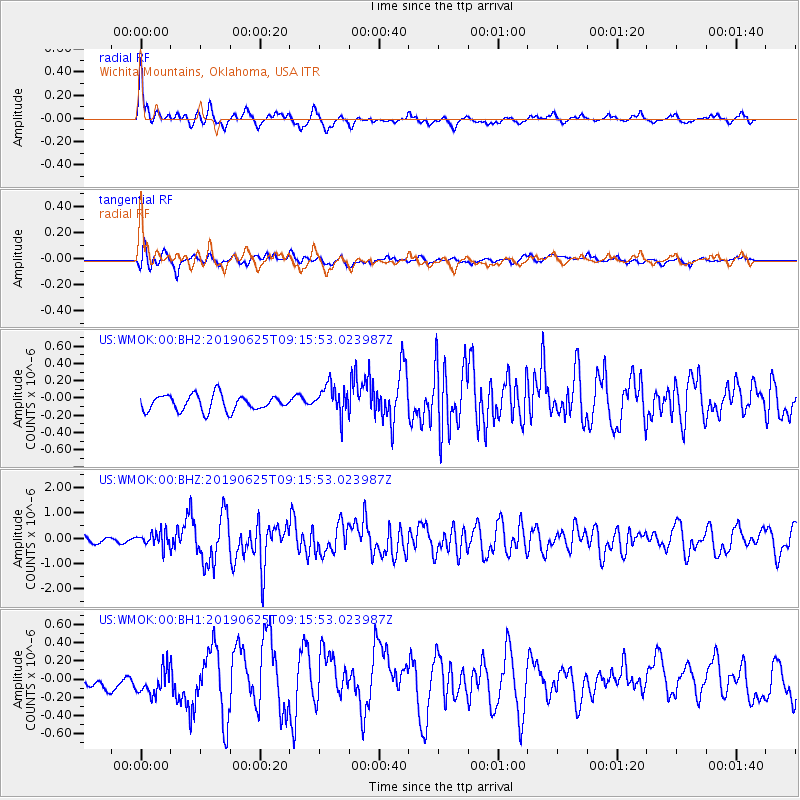
WMOK Wichita Mountains, Oklahoma, USA - Earthquake Result Viewer
*The percent match for this event was below the threshold and hence no stack was calculated.
| Earthquake location: |
Komandorskiye Ostrova Region |
| Earthquake latitude/longitude: |
56.2/164.3 |
| Earthquake time(UTC): |
2019/06/25 (176) 09:05:44 GMT |
| Earthquake Depth: |
33 km |
| Earthquake Magnitude: |
6.6 Mi |
| Earthquake Catalog/Contributor: |
NEIC PDE/at |
|
| Network: |
US United States National Seismic Network |
| Station: |
WMOK Wichita Mountains, Oklahoma, USA |
| Lat/Lon: |
34.74 N/98.78 W |
| Elevation: |
486 m |
|
| Distance: |
65.5 deg |
| Az: |
63.97 deg |
| Baz: |
322.427 deg |
| Ray Param: |
$rayparam |
*The percent match for this event was below the threshold and hence was not used in the summary stack. |
|
| Radial Match: |
76.992836 % |
| Radial Bump: |
400 |
| Transverse Match: |
67.79968 % |
| Transverse Bump: |
400 |
| SOD ConfigId: |
18369291 |
| Insert Time: |
2019-07-09 09:15:32.483 +0000 |
| GWidth: |
2.5 |
| Max Bumps: |
400 |
| Tol: |
0.001 |
|
Signal To Noise
| Channel | StoN | STA | LTA |
| US:WMOK:00:BHZ:20190625T09:15:53.023987Z | 1.9744369 | 2.7630213E-7 | 1.3993971E-7 |
| US:WMOK:00:BH1:20190625T09:15:53.023987Z | 0.8973303 | 1.5361259E-7 | 1.7118846E-7 |
| US:WMOK:00:BH2:20190625T09:15:53.023987Z | 1.9085186 | 1.7322093E-7 | 9.076198E-8 |
| Arrivals |
| Ps | |
| PpPs | |
| PsPs/PpSs | |


