You are here: Home > Network List > TA - USArray Transportable Network (new EarthScope stations) Stations List
> Station B17A L&G Farms, Chester, MT, USA > Earthquake Result Viewer
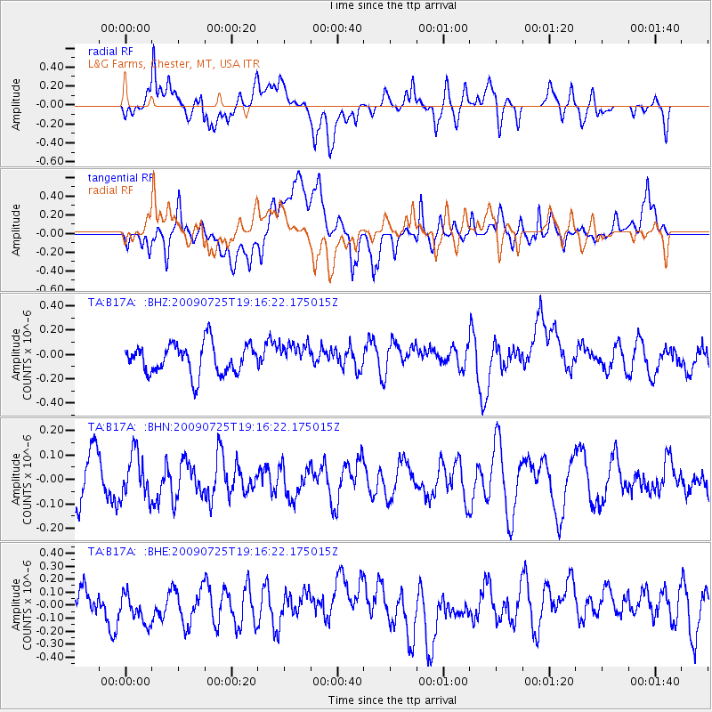
B17A L&G Farms, Chester, MT, USA - Earthquake Result Viewer
*The percent match for this event was below the threshold and hence no stack was calculated.
| Earthquake location: |
Kermadec Islands, New Zealand |
| Earthquake latitude/longitude: |
-29.8/-177.7 |
| Earthquake time(UTC): |
2009/07/25 (206) 19:03:20 GMT |
| Earthquake Depth: |
35 km |
| Earthquake Magnitude: |
5.5 MB, 5.2 MS, 5.6 MW, 5.6 MW |
| Earthquake Catalog/Contributor: |
WHDF/NEIC |
|
| Network: |
TA USArray Transportable Network (new EarthScope stations) |
| Station: |
B17A L&G Farms, Chester, MT, USA |
| Lat/Lon: |
48.29 N/110.80 W |
| Elevation: |
894 m |
|
| Distance: |
98.0 deg |
| Az: |
38.342 deg |
| Baz: |
233.864 deg |
| Ray Param: |
$rayparam |
*The percent match for this event was below the threshold and hence was not used in the summary stack. |
|
| Radial Match: |
55.113464 % |
| Radial Bump: |
400 |
| Transverse Match: |
58.00665 % |
| Transverse Bump: |
400 |
| SOD ConfigId: |
2648 |
| Insert Time: |
2010-03-07 00:41:16.911 +0000 |
| GWidth: |
2.5 |
| Max Bumps: |
400 |
| Tol: |
0.001 |
|
Signal To Noise
| Channel | StoN | STA | LTA |
| TA:B17A: :BHN:20090725T19:16:22.175015Z | 0.81896144 | 9.057029E-8 | 1.1059164E-7 |
| TA:B17A: :BHE:20090725T19:16:22.175015Z | 1.044859 | 1.3218727E-7 | 1.2651206E-7 |
| TA:B17A: :BHZ:20090725T19:16:22.175015Z | 0.8514056 | 1.0463393E-7 | 1.2289553E-7 |
| Arrivals |
| Ps | |
| PpPs | |
| PsPs/PpSs | |


