You are here: Home > Network List > TA - USArray Transportable Network (new EarthScope stations) Stations List
> Station B17A L&G Farms, Chester, MT, USA > Earthquake Result Viewer
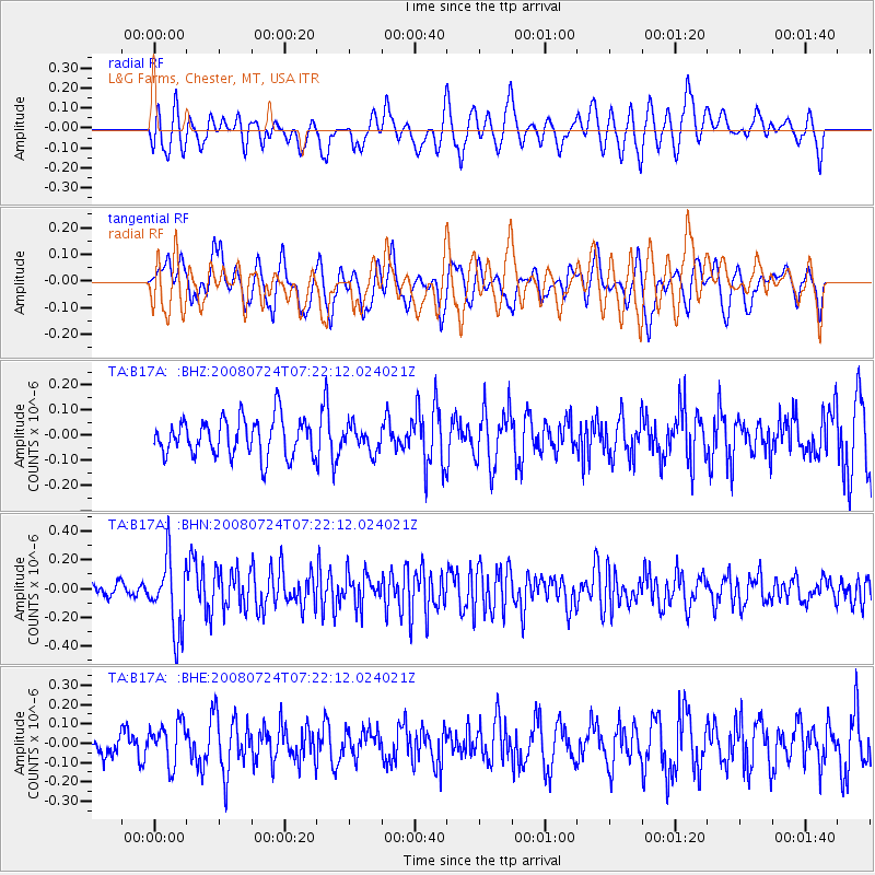
B17A L&G Farms, Chester, MT, USA - Earthquake Result Viewer
*The percent match for this event was below the threshold and hence no stack was calculated.
| Earthquake location: |
Sichuan, China |
| Earthquake latitude/longitude: |
32.7/105.5 |
| Earthquake time(UTC): |
2008/07/24 (206) 07:09:30 GMT |
| Earthquake Depth: |
10 km |
| Earthquake Magnitude: |
5.6 MB, 5.4 MS, 5.7 MW, 5.6 MW |
| Earthquake Catalog/Contributor: |
WHDF/NEIC |
|
| Network: |
TA USArray Transportable Network (new EarthScope stations) |
| Station: |
B17A L&G Farms, Chester, MT, USA |
| Lat/Lon: |
48.29 N/110.80 W |
| Elevation: |
894 m |
|
| Distance: |
93.0 deg |
| Az: |
23.347 deg |
| Baz: |
329.995 deg |
| Ray Param: |
$rayparam |
*The percent match for this event was below the threshold and hence was not used in the summary stack. |
|
| Radial Match: |
49.83901 % |
| Radial Bump: |
400 |
| Transverse Match: |
54.47169 % |
| Transverse Bump: |
400 |
| SOD ConfigId: |
2504 |
| Insert Time: |
2010-03-07 00:41:32.455 +0000 |
| GWidth: |
2.5 |
| Max Bumps: |
400 |
| Tol: |
0.001 |
|
Signal To Noise
| Channel | StoN | STA | LTA |
| TA:B17A: :BHN:20080724T07:22:12.024021Z | 2.9409277 | 2.511331E-7 | 8.539247E-8 |
| TA:B17A: :BHE:20080724T07:22:12.024021Z | 1.2777423 | 1.0769332E-7 | 8.4284075E-8 |
| TA:B17A: :BHZ:20080724T07:22:12.024021Z | 0.6621427 | 4.9509786E-8 | 7.477208E-8 |
| Arrivals |
| Ps | |
| PpPs | |
| PsPs/PpSs | |


