You are here: Home > Network List > TA - USArray Transportable Network (new EarthScope stations) Stations List
> Station B17A L&G Farms, Chester, MT, USA > Earthquake Result Viewer
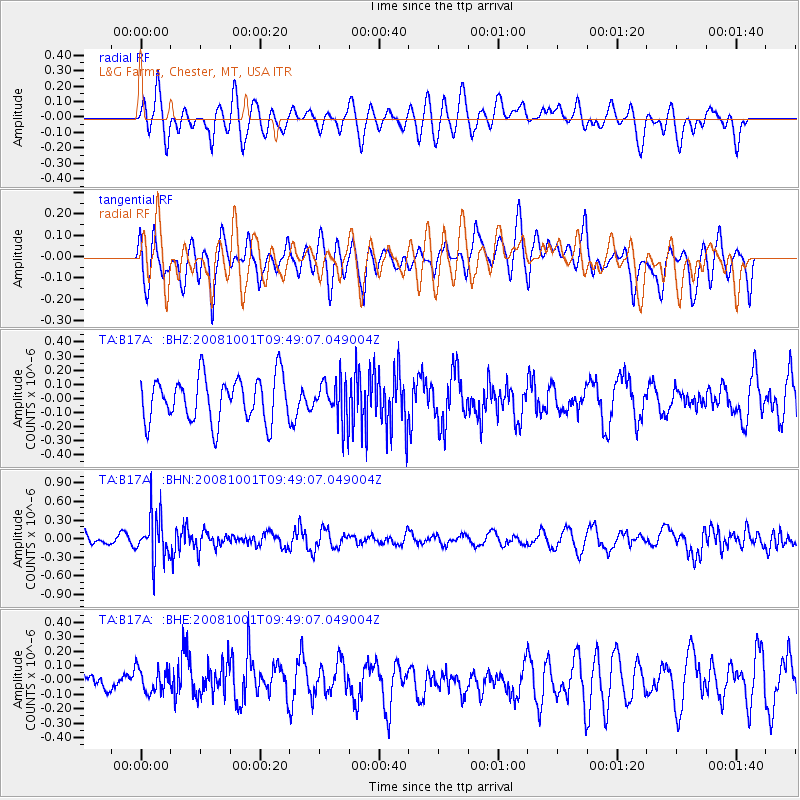
B17A L&G Farms, Chester, MT, USA - Earthquake Result Viewer
*The percent match for this event was below the threshold and hence no stack was calculated.
| Earthquake location: |
Southeast Of Honshu, Japan |
| Earthquake latitude/longitude: |
30.2/138.8 |
| Earthquake time(UTC): |
2008/10/01 (275) 09:38:12 GMT |
| Earthquake Depth: |
414 km |
| Earthquake Magnitude: |
5.7 MW, 5.1 MB, 5.7 MW |
| Earthquake Catalog/Contributor: |
WHDF/NEIC |
|
| Network: |
TA USArray Transportable Network (new EarthScope stations) |
| Station: |
B17A L&G Farms, Chester, MT, USA |
| Lat/Lon: |
48.29 N/110.80 W |
| Elevation: |
894 m |
|
| Distance: |
80.2 deg |
| Az: |
39.43 deg |
| Baz: |
304.548 deg |
| Ray Param: |
$rayparam |
*The percent match for this event was below the threshold and hence was not used in the summary stack. |
|
| Radial Match: |
42.5013 % |
| Radial Bump: |
400 |
| Transverse Match: |
51.562885 % |
| Transverse Bump: |
400 |
| SOD ConfigId: |
2556 |
| Insert Time: |
2010-03-07 00:41:35.688 +0000 |
| GWidth: |
2.5 |
| Max Bumps: |
400 |
| Tol: |
0.001 |
|
Signal To Noise
| Channel | StoN | STA | LTA |
| TA:B17A: :BHN:20081001T09:49:07.049004Z | 3.0234554 | 3.6451166E-7 | 1.2056128E-7 |
| TA:B17A: :BHE:20081001T09:49:07.049004Z | 0.7409057 | 9.488798E-8 | 1.2807025E-7 |
| TA:B17A: :BHZ:20081001T09:49:07.049004Z | 0.9277429 | 1.4594764E-7 | 1.5731476E-7 |
| Arrivals |
| Ps | |
| PpPs | |
| PsPs/PpSs | |


