You are here: Home > Network List > TA - USArray Transportable Network (new EarthScope stations) Stations List
> Station B17A L&G Farms, Chester, MT, USA > Earthquake Result Viewer
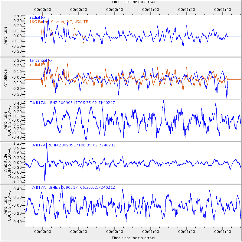
B17A L&G Farms, Chester, MT, USA - Earthquake Result Viewer
*The percent match for this event was below the threshold and hence no stack was calculated.
| Earthquake location: |
Tonga Islands |
| Earthquake latitude/longitude: |
-16.8/-173.5 |
| Earthquake time(UTC): |
2009/05/17 (137) 06:23:03 GMT |
| Earthquake Depth: |
67 km |
| Earthquake Magnitude: |
5.5 MB, 5.6 MW, 5.6 MW |
| Earthquake Catalog/Contributor: |
WHDF/NEIC |
|
| Network: |
TA USArray Transportable Network (new EarthScope stations) |
| Station: |
B17A L&G Farms, Chester, MT, USA |
| Lat/Lon: |
48.29 N/110.80 W |
| Elevation: |
894 m |
|
| Distance: |
85.5 deg |
| Az: |
36.532 deg |
| Baz: |
238.615 deg |
| Ray Param: |
$rayparam |
*The percent match for this event was below the threshold and hence was not used in the summary stack. |
|
| Radial Match: |
44.256775 % |
| Radial Bump: |
368 |
| Transverse Match: |
70.33594 % |
| Transverse Bump: |
400 |
| SOD ConfigId: |
2760 |
| Insert Time: |
2010-03-07 00:41:50.869 +0000 |
| GWidth: |
2.5 |
| Max Bumps: |
400 |
| Tol: |
0.001 |
|
Signal To Noise
| Channel | StoN | STA | LTA |
| TA:B17A: :BHN:20090517T06:35:02.724021Z | 3.674326 | 5.0134696E-7 | 1.3644598E-7 |
| TA:B17A: :BHE:20090517T06:35:02.724021Z | 1.0556519 | 2.0136919E-7 | 1.9075341E-7 |
| TA:B17A: :BHZ:20090517T06:35:02.724021Z | 1.1845207 | 2.1592999E-7 | 1.8229312E-7 |
| Arrivals |
| Ps | |
| PpPs | |
| PsPs/PpSs | |


