You are here: Home > Network List > TA - USArray Transportable Network (new EarthScope stations) Stations List
> Station C20A Veseth Ranch, Zortman, MT, USA > Earthquake Result Viewer
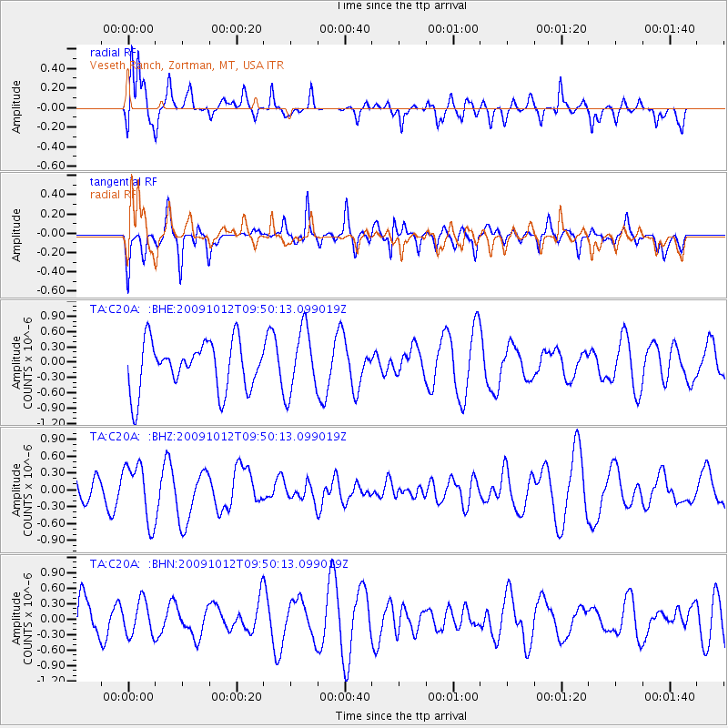
C20A Veseth Ranch, Zortman, MT, USA - Earthquake Result Viewer
*The percent match for this event was below the threshold and hence no stack was calculated.
| Earthquake location: |
Santa Cruz Islands |
| Earthquake latitude/longitude: |
-12.4/166.5 |
| Earthquake time(UTC): |
2009/10/12 (285) 09:37:21 GMT |
| Earthquake Depth: |
42 km |
| Earthquake Magnitude: |
5.9 MB, 5.9 MS, 6.2 MW, 6.2 MW |
| Earthquake Catalog/Contributor: |
WHDF/NEIC |
|
| Network: |
TA USArray Transportable Network (new EarthScope stations) |
| Station: |
C20A Veseth Ranch, Zortman, MT, USA |
| Lat/Lon: |
47.71 N/108.00 W |
| Elevation: |
781 m |
|
| Distance: |
96.1 deg |
| Az: |
42.612 deg |
| Baz: |
258.35 deg |
| Ray Param: |
$rayparam |
*The percent match for this event was below the threshold and hence was not used in the summary stack. |
|
| Radial Match: |
69.85031 % |
| Radial Bump: |
381 |
| Transverse Match: |
56.48088 % |
| Transverse Bump: |
400 |
| SOD ConfigId: |
2622 |
| Insert Time: |
2010-03-07 00:43:51.720 +0000 |
| GWidth: |
2.5 |
| Max Bumps: |
400 |
| Tol: |
0.001 |
|
Signal To Noise
| Channel | StoN | STA | LTA |
| TA:C20A: :BHZ:20091012T09:50:13.099019Z | 2.264335 | 5.178307E-7 | 2.2868998E-7 |
| TA:C20A: :BHN:20091012T09:50:13.099019Z | 0.8275759 | 3.335121E-7 | 4.0299878E-7 |
| TA:C20A: :BHE:20091012T09:50:13.099019Z | 1.31697 | 6.295728E-7 | 4.780464E-7 |
| Arrivals |
| Ps | |
| PpPs | |
| PsPs/PpSs | |


