You are here: Home > Network List > UU - University of Utah Regional Network Stations List
> Station FORU South Mineral Mountains, UT, USA > Earthquake Result Viewer
FORU South Mineral Mountains, UT, USA - Earthquake Result Viewer

| Earthquake location: |
Komandorskiye Ostrova Region |
| Earthquake latitude/longitude: |
56.2/164.1 |
| Earthquake time(UTC): |
2019/06/26 (177) 02:18:07 GMT |
| Earthquake Depth: |
10 km |
| Earthquake Magnitude: |
6.4 Mww |
| Earthquake Catalog/Contributor: |
NEIC PDE/us |
|
| Network: |
UU University of Utah Regional Network |
| Station: |
FORU South Mineral Mountains, UT, USA |
| Lat/Lon: |
38.46 N/112.86 W |
| Elevation: |
1840 m |
|
| Distance: |
55.5 deg |
| Az: |
71.091 deg |
| Baz: |
317.658 deg |
| Ray Param: |
0.06478133 |
| Estimated Moho Depth: |
46.75 km |
| Estimated Crust Vp/Vs: |
2.06 |
| Assumed Crust Vp: |
6.276 km/s |
| Estimated Crust Vs: |
3.047 km/s |
| Estimated Crust Poisson's Ratio: |
0.35 |
|
| Radial Match: |
83.356155 % |
| Radial Bump: |
400 |
| Transverse Match: |
80.55633 % |
| Transverse Bump: |
400 |
| SOD ConfigId: |
18369291 |
| Insert Time: |
2019-07-10 02:31:40.309 +0000 |
| GWidth: |
2.5 |
| Max Bumps: |
400 |
| Tol: |
0.001 |
|
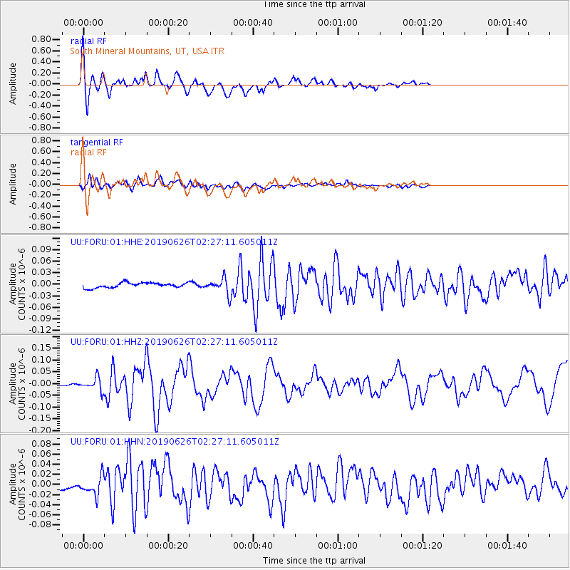
Signal To Noise
| Channel | StoN | STA | LTA |
| UU:FORU:01:HHZ:20190626T02:27:11.605011Z | 14.154134 | 2.7879645E-8 | 1.9697175E-9 |
| UU:FORU:01:HHN:20190626T02:27:11.605011Z | 1.6306787 | 1.9814015E-8 | 1.2150779E-8 |
| UU:FORU:01:HHE:20190626T02:27:11.605011Z | 3.2270572 | 2.094038E-8 | 6.489002E-9 |
| Arrivals |
| Ps | 8.2 SECOND |
| PpPs | 22 SECOND |
| PsPs/PpSs | 30 SECOND |


