You are here: Home > Network List > TA - USArray Transportable Network (new EarthScope stations) Stations List
> Station A19A Klindworth Farms, Hogeland, MT, USA > Earthquake Result Viewer
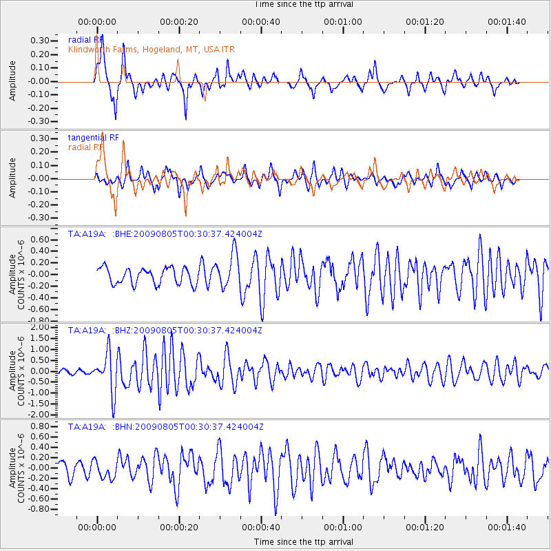
A19A Klindworth Farms, Hogeland, MT, USA - Earthquake Result Viewer
*The percent match for this event was below the threshold and hence no stack was calculated.
| Earthquake location: |
Southwestern Ryukyu Isl., Japan |
| Earthquake latitude/longitude: |
24.2/125.1 |
| Earthquake time(UTC): |
2009/08/05 (217) 00:17:58 GMT |
| Earthquake Depth: |
25 km |
| Earthquake Magnitude: |
5.9 MB, 5.9 MS, 6.2 MW, 6.1 MW |
| Earthquake Catalog/Contributor: |
WHDF/NEIC |
|
| Network: |
TA USArray Transportable Network (new EarthScope stations) |
| Station: |
A19A Klindworth Farms, Hogeland, MT, USA |
| Lat/Lon: |
48.93 N/108.74 W |
| Elevation: |
971 m |
|
| Distance: |
92.8 deg |
| Az: |
32.214 deg |
| Baz: |
312.447 deg |
| Ray Param: |
$rayparam |
*The percent match for this event was below the threshold and hence was not used in the summary stack. |
|
| Radial Match: |
77.17139 % |
| Radial Bump: |
343 |
| Transverse Match: |
58.231194 % |
| Transverse Bump: |
331 |
| SOD ConfigId: |
2622 |
| Insert Time: |
2010-03-07 00:45:27.835 +0000 |
| GWidth: |
2.5 |
| Max Bumps: |
400 |
| Tol: |
0.001 |
|
Signal To Noise
| Channel | StoN | STA | LTA |
| TA:A19A: :BHZ:20090805T00:30:37.424004Z | 7.1527767 | 9.3109327E-7 | 1.3017228E-7 |
| TA:A19A: :BHN:20090805T00:30:37.424004Z | 1.0158978 | 1.6426824E-7 | 1.6169761E-7 |
| TA:A19A: :BHE:20090805T00:30:37.424004Z | 2.1962066 | 3.0264442E-7 | 1.3780326E-7 |
| Arrivals |
| Ps | |
| PpPs | |
| PsPs/PpSs | |


