You are here: Home > Network List > IU - Global Seismograph Network (GSN - IRIS/USGS) Stations List
> Station PMG Port Moresby, New Guinea > Earthquake Result Viewer
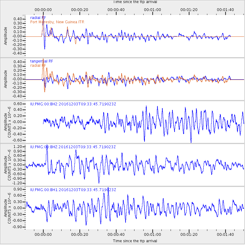
PMG Port Moresby, New Guinea - Earthquake Result Viewer
*The percent match for this event was below the threshold and hence no stack was calculated.
| Earthquake location: |
Near Islands, Aleutian Islands |
| Earthquake latitude/longitude: |
52.2/174.2 |
| Earthquake time(UTC): |
2016/12/03 (338) 09:23:34 GMT |
| Earthquake Depth: |
27 km |
| Earthquake Magnitude: |
6.0 mb |
| Earthquake Catalog/Contributor: |
NEIC PDE/us |
|
| Network: |
IU Global Seismograph Network (GSN - IRIS/USGS) |
| Station: |
PMG Port Moresby, New Guinea |
| Lat/Lon: |
9.40 S/147.16 E |
| Elevation: |
90 m |
|
| Distance: |
65.6 deg |
| Az: |
209.5 deg |
| Baz: |
17.869 deg |
| Ray Param: |
$rayparam |
*The percent match for this event was below the threshold and hence was not used in the summary stack. |
|
| Radial Match: |
79.66832 % |
| Radial Bump: |
400 |
| Transverse Match: |
71.6169 % |
| Transverse Bump: |
400 |
| SOD ConfigId: |
1894071 |
| Insert Time: |
2016-12-17 09:27:02.583 +0000 |
| GWidth: |
2.5 |
| Max Bumps: |
400 |
| Tol: |
0.001 |
|
Signal To Noise
| Channel | StoN | STA | LTA |
| IU:PMG:00:BHZ:20161203T09:33:45.719023Z | 5.47788 | 4.831195E-7 | 8.819461E-8 |
| IU:PMG:00:BH1:20161203T09:33:45.719023Z | 3.0866153 | 2.6646373E-7 | 8.6328775E-8 |
| IU:PMG:00:BH2:20161203T09:33:45.719023Z | 1.6273347 | 1.6139309E-7 | 9.917633E-8 |
| Arrivals |
| Ps | |
| PpPs | |
| PsPs/PpSs | |


