You are here: Home > Network List > BK - Berkeley Digital Seismograph Network Stations List
> Station HUMO Hull Mountain, OR > Earthquake Result Viewer
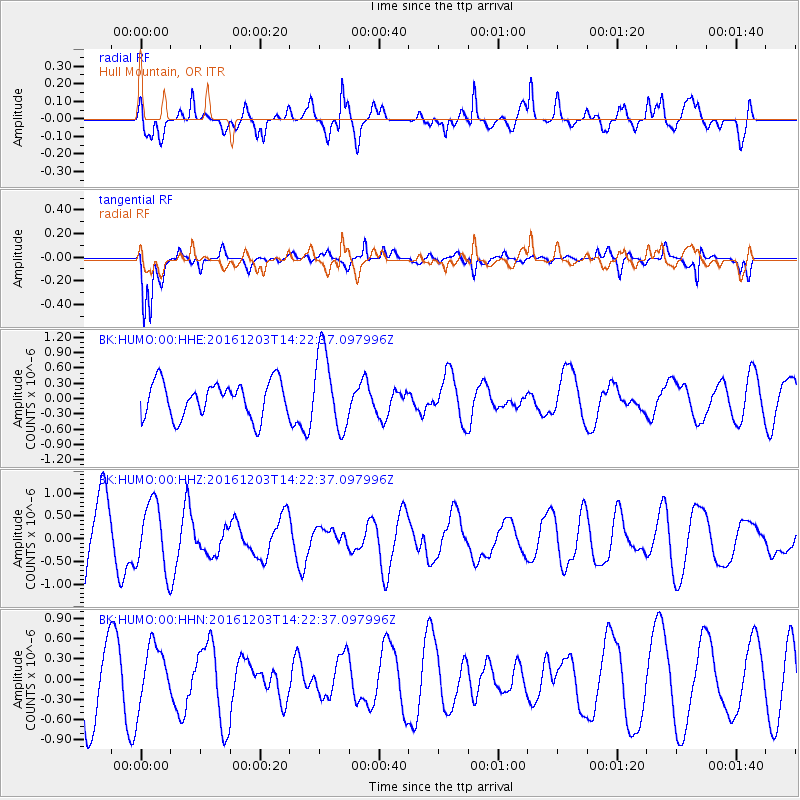
HUMO Hull Mountain, OR - Earthquake Result Viewer
*The percent match for this event was below the threshold and hence no stack was calculated.
| Earthquake location: |
South Of Fiji Islands |
| Earthquake latitude/longitude: |
-22.6/-176.0 |
| Earthquake time(UTC): |
2016/12/03 (338) 14:11:09 GMT |
| Earthquake Depth: |
153 km |
| Earthquake Magnitude: |
5.5 mb |
| Earthquake Catalog/Contributor: |
NEIC PDE/us |
|
| Network: |
BK Berkeley Digital Seismograph Network |
| Station: |
HUMO Hull Mountain, OR |
| Lat/Lon: |
42.61 N/122.96 W |
| Elevation: |
555 m |
|
| Distance: |
81.2 deg |
| Az: |
36.665 deg |
| Baz: |
228.379 deg |
| Ray Param: |
$rayparam |
*The percent match for this event was below the threshold and hence was not used in the summary stack. |
|
| Radial Match: |
65.6276 % |
| Radial Bump: |
400 |
| Transverse Match: |
78.4176 % |
| Transverse Bump: |
379 |
| SOD ConfigId: |
1894071 |
| Insert Time: |
2016-12-17 14:13:45.782 +0000 |
| GWidth: |
2.5 |
| Max Bumps: |
400 |
| Tol: |
0.001 |
|
Signal To Noise
| Channel | StoN | STA | LTA |
| BK:HUMO:00:HHZ:20161203T14:22:37.097996Z | 1.229854 | 7.309443E-7 | 5.9433415E-7 |
| BK:HUMO:00:HHN:20161203T14:22:37.097996Z | 1.0612454 | 4.5790782E-7 | 4.314815E-7 |
| BK:HUMO:00:HHE:20161203T14:22:37.097996Z | 2.2121353 | 7.608616E-7 | 3.4394893E-7 |
| Arrivals |
| Ps | |
| PpPs | |
| PsPs/PpSs | |


