You are here: Home > Network List > GS - US Geological Survey Networks Stations List
> Station KAN10 Keim Farm > Earthquake Result Viewer
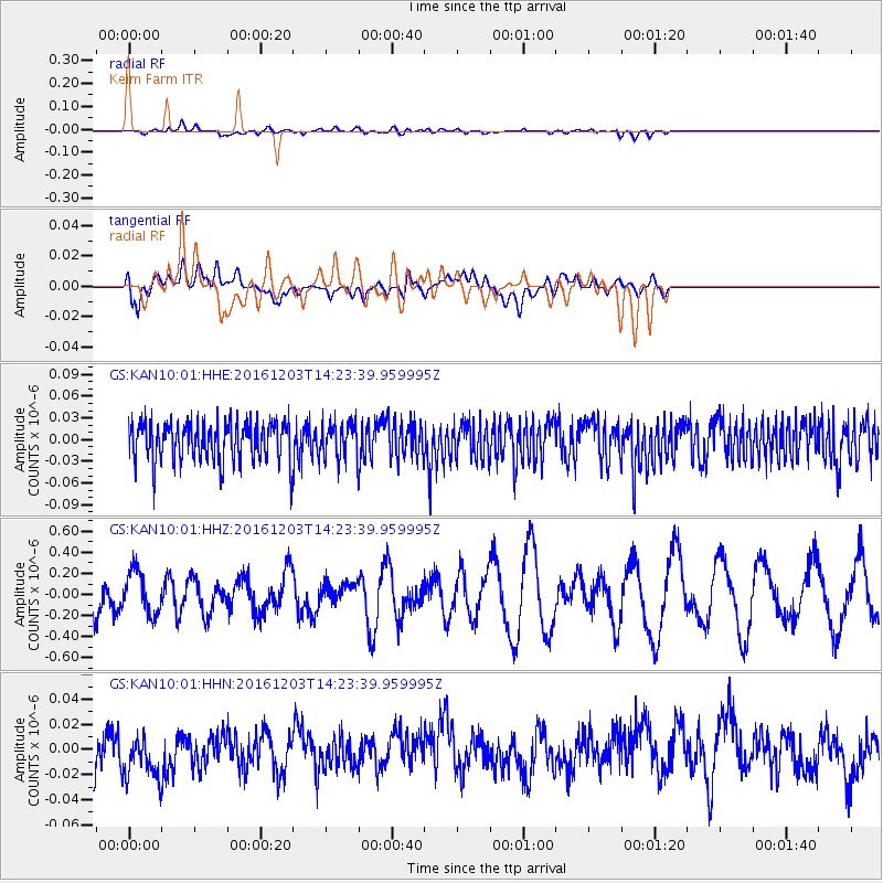
KAN10 Keim Farm - Earthquake Result Viewer
*The percent match for this event was below the threshold and hence no stack was calculated.
| Earthquake location: |
South Of Fiji Islands |
| Earthquake latitude/longitude: |
-22.6/-176.0 |
| Earthquake time(UTC): |
2016/12/03 (338) 14:11:09 GMT |
| Earthquake Depth: |
153 km |
| Earthquake Magnitude: |
5.5 mb |
| Earthquake Catalog/Contributor: |
NEIC PDE/us |
|
| Network: |
GS US Geological Survey Networks |
| Station: |
KAN10 Keim Farm |
| Lat/Lon: |
37.12 N/98.10 W |
| Elevation: |
417 m |
|
| Distance: |
94.3 deg |
| Az: |
51.612 deg |
| Baz: |
245.008 deg |
| Ray Param: |
$rayparam |
*The percent match for this event was below the threshold and hence was not used in the summary stack. |
|
| Radial Match: |
33.758274 % |
| Radial Bump: |
400 |
| Transverse Match: |
50.35033 % |
| Transverse Bump: |
400 |
| SOD ConfigId: |
1894071 |
| Insert Time: |
2016-12-17 14:14:15.324 +0000 |
| GWidth: |
2.5 |
| Max Bumps: |
400 |
| Tol: |
0.001 |
|
Signal To Noise
| Channel | StoN | STA | LTA |
| GS:KAN10:01:HHZ:20161203T14:23:39.959995Z | 0.84455603 | 2.0617888E-7 | 2.4412697E-7 |
| GS:KAN10:01:HHN:20161203T14:23:39.959995Z | 1.022181 | 1.8291319E-8 | 1.7894402E-8 |
| GS:KAN10:01:HHE:20161203T14:23:39.959995Z | 0.9371862 | 2.5219627E-8 | 2.6909943E-8 |
| Arrivals |
| Ps | |
| PpPs | |
| PsPs/PpSs | |


