You are here: Home > Network List > II - Global Seismograph Network (GSN - IRIS/IDA) Stations List
> Station WRAB Tennant Creek, NT, Australia > Earthquake Result Viewer
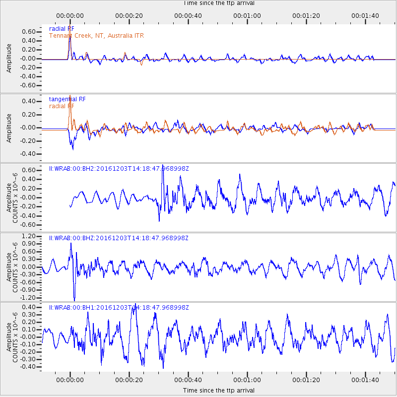
WRAB Tennant Creek, NT, Australia - Earthquake Result Viewer
*The percent match for this event was below the threshold and hence no stack was calculated.
| Earthquake location: |
South Of Fiji Islands |
| Earthquake latitude/longitude: |
-22.6/-176.0 |
| Earthquake time(UTC): |
2016/12/03 (338) 14:11:09 GMT |
| Earthquake Depth: |
153 km |
| Earthquake Magnitude: |
5.5 mb |
| Earthquake Catalog/Contributor: |
NEIC PDE/us |
|
| Network: |
II Global Seismograph Network (GSN - IRIS/IDA) |
| Station: |
WRAB Tennant Creek, NT, Australia |
| Lat/Lon: |
19.93 S/134.36 E |
| Elevation: |
366 m |
|
| Distance: |
46.1 deg |
| Az: |
263.592 deg |
| Baz: |
102.514 deg |
| Ray Param: |
$rayparam |
*The percent match for this event was below the threshold and hence was not used in the summary stack. |
|
| Radial Match: |
65.412575 % |
| Radial Bump: |
400 |
| Transverse Match: |
61.0263 % |
| Transverse Bump: |
400 |
| SOD ConfigId: |
1894071 |
| Insert Time: |
2016-12-17 14:14:37.974 +0000 |
| GWidth: |
2.5 |
| Max Bumps: |
400 |
| Tol: |
0.001 |
|
Signal To Noise
| Channel | StoN | STA | LTA |
| II:WRAB:00:BHZ:20161203T14:18:47.968998Z | 2.9290414 | 5.040413E-7 | 1.7208406E-7 |
| II:WRAB:00:BH1:20161203T14:18:47.968998Z | 1.0372695 | 9.3216514E-8 | 8.9867214E-8 |
| II:WRAB:00:BH2:20161203T14:18:47.968998Z | 2.9873545 | 2.8773277E-7 | 9.631692E-8 |
| Arrivals |
| Ps | |
| PpPs | |
| PsPs/PpSs | |


