You are here: Home > Network List > US - United States National Seismic Network Stations List
> Station EGMT Eagleton, Montana, USA > Earthquake Result Viewer
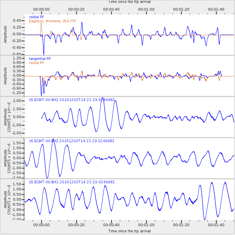
EGMT Eagleton, Montana, USA - Earthquake Result Viewer
*The percent match for this event was below the threshold and hence no stack was calculated.
| Earthquake location: |
South Of Fiji Islands |
| Earthquake latitude/longitude: |
-22.6/-176.0 |
| Earthquake time(UTC): |
2016/12/03 (338) 14:11:09 GMT |
| Earthquake Depth: |
153 km |
| Earthquake Magnitude: |
5.5 mb |
| Earthquake Catalog/Contributor: |
NEIC PDE/us |
|
| Network: |
US United States National Seismic Network |
| Station: |
EGMT Eagleton, Montana, USA |
| Lat/Lon: |
48.02 N/109.75 W |
| Elevation: |
1055 m |
|
| Distance: |
91.9 deg |
| Az: |
37.944 deg |
| Baz: |
237.842 deg |
| Ray Param: |
$rayparam |
*The percent match for this event was below the threshold and hence was not used in the summary stack. |
|
| Radial Match: |
74.50731 % |
| Radial Bump: |
400 |
| Transverse Match: |
82.28781 % |
| Transverse Bump: |
400 |
| SOD ConfigId: |
1894071 |
| Insert Time: |
2016-12-17 14:15:22.465 +0000 |
| GWidth: |
2.5 |
| Max Bumps: |
400 |
| Tol: |
0.001 |
|
Signal To Noise
| Channel | StoN | STA | LTA |
| US:EGMT:00:BHZ:20161203T14:23:29.024998Z | 2.3832505 | 1.2862107E-6 | 5.3968756E-7 |
| US:EGMT:00:BH1:20161203T14:23:29.024998Z | 1.7039942 | 9.358522E-7 | 5.4921094E-7 |
| US:EGMT:00:BH2:20161203T14:23:29.024998Z | 2.2901475 | 1.3534428E-6 | 5.90985E-7 |
| Arrivals |
| Ps | |
| PpPs | |
| PsPs/PpSs | |


