You are here: Home > Network List > TA - USArray Transportable Network (new EarthScope stations) Stations List
> Station B19A Brinkman Farms, Chinook, MT, USA > Earthquake Result Viewer
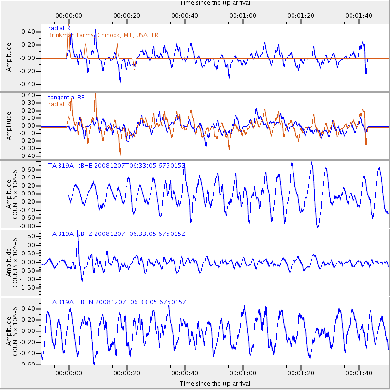
B19A Brinkman Farms, Chinook, MT, USA - Earthquake Result Viewer
*The percent match for this event was below the threshold and hence no stack was calculated.
| Earthquake location: |
Northern Mid-Atlantic Ridge |
| Earthquake latitude/longitude: |
13.4/-44.8 |
| Earthquake time(UTC): |
2008/12/07 (342) 06:23:09 GMT |
| Earthquake Depth: |
10 km |
| Earthquake Magnitude: |
5.6 MB, 5.3 MS, 5.7 MW |
| Earthquake Catalog/Contributor: |
WHDF/NEIC |
|
| Network: |
TA USArray Transportable Network (new EarthScope stations) |
| Station: |
B19A Brinkman Farms, Chinook, MT, USA |
| Lat/Lon: |
48.46 N/108.94 W |
| Elevation: |
803 m |
|
| Distance: |
63.0 deg |
| Az: |
317.762 deg |
| Baz: |
100.627 deg |
| Ray Param: |
$rayparam |
*The percent match for this event was below the threshold and hence was not used in the summary stack. |
|
| Radial Match: |
48.814022 % |
| Radial Bump: |
400 |
| Transverse Match: |
50.573563 % |
| Transverse Bump: |
400 |
| SOD ConfigId: |
2658 |
| Insert Time: |
2010-03-07 00:48:51.072 +0000 |
| GWidth: |
2.5 |
| Max Bumps: |
400 |
| Tol: |
0.001 |
|
Signal To Noise
| Channel | StoN | STA | LTA |
| TA:B19A: :BHZ:20081207T06:33:05.675015Z | 5.395338 | 6.7974423E-7 | 1.2598734E-7 |
| TA:B19A: :BHN:20081207T06:33:05.675015Z | 1.22182 | 2.6144124E-7 | 2.1397689E-7 |
| TA:B19A: :BHE:20081207T06:33:05.675015Z | 1.4396651 | 2.9701232E-7 | 2.0630652E-7 |
| Arrivals |
| Ps | |
| PpPs | |
| PsPs/PpSs | |


